Chevaleret (Paris Métro)
Chevaleret | |||||||||||
|---|---|---|---|---|---|---|---|---|---|---|---|
| Paris Métro station | |||||||||||
 | |||||||||||
| Location |
13th arrondissement of Paris Île-de-France France | ||||||||||
| Coordinates | 48°50′06″N 2°22′05″E / 48.834938°N 2.368082°ECoordinates: 48°50′06″N 2°22′05″E / 48.834938°N 2.368082°E | ||||||||||
| Owned by | RATP | ||||||||||
| Operated by | RATP | ||||||||||
| Other information | |||||||||||
| Fare zone | 1 | ||||||||||
| History | |||||||||||
| Opened | 1 March 1909 | ||||||||||
| Services | |||||||||||
| |||||||||||
| Location | |||||||||||
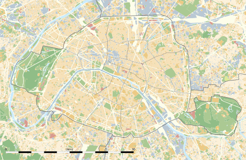 Chevaleret Location within Paris | |||||||||||
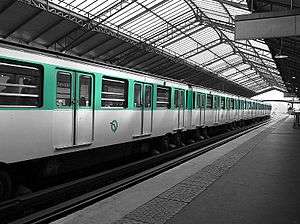
Chevaleret is an elevated station of the Paris Métro serving line 6 at the intersection of the Rue du Chevaleret and the Boulevard Vincent Auriol in the 13th arrondissement.
The station opened on 1 March 1909 with the opening of the original section of line 6 from Place d'Italie to Nation (although part of line 5—some dating back to 2 October 1900—was incorporated into line 6 on 12 October 1942). It is named after the Rue de Chevaleret, a street that already existed in 1670, and was named after the locality, which in turn was probably named after its owner.
Nearby are the Pitié-Salpêtrière Hospital and the Ministry of Finance.
Station layout
| Platform level | ||
| toward Charles de Gaulle – Étoile | ← | |
| toward Nation | | |
| 1F | Mezzanine for platform connection |
| Street Level |
| Wikimedia Commons has media related to Chevaleret (Paris Metro). |
References
- Roland, Gérard (2003). Stations de métro. D’Abbesses à Wagram. Éditions Bonneton.
This article is issued from Wikipedia - version of the 11/18/2016. The text is available under the Creative Commons Attribution/Share Alike but additional terms may apply for the media files.