Cheesequake, New Jersey
| Cheesequake, New Jersey | |
|---|---|
| Unincorporated community | |
|
Center of Cheesequake along Route 34 | |
 Cheesequake, New Jersey  Cheesequake, New Jersey  Cheesequake, New Jersey Location of Cheesequake in Middlesex County Inset: Location of county within the state of New Jersey | |
| Coordinates: 40°25′29″N 74°17′16″W / 40.42472°N 74.28778°WCoordinates: 40°25′29″N 74°17′16″W / 40.42472°N 74.28778°W | |
| Country |
|
| State |
|
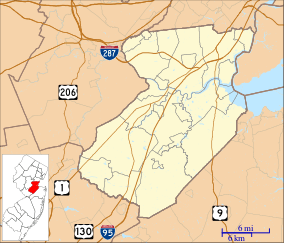
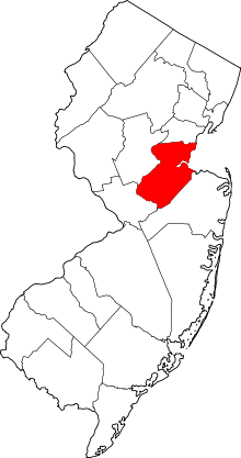
| County | Middlesex |
| Township | Old Bridge |
| Elevation[1] | 102 ft (31 m) |
| Time zone | Eastern (EST) (UTC-5) |
| • Summer (DST) | EDT (UTC-4) |
| Area code(s) | 732 & 848 |
| GNIS feature ID | 875383[1] |
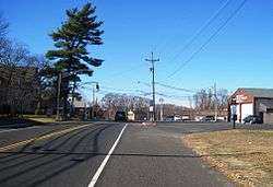
Cheesequake is an unincorporated community located within Old Bridge Township in Middlesex County, New Jersey, United States.[2] Cheesequake is located along Route 34, south of Cheesequake State Park.[3][4] The community's name comes from the Lenni Lenape word "Cheseh-oh-ke", meaning "upland".[5]
References
- 1 2 "Cheesequake". Geographic Names Information System. United States Geological Survey.
- ↑ Locality Search, State of New Jersey. Accessed February 7, 2015.
- ↑ Middlesex County (PDF) (Map). New Jersey Department of Transportation. Retrieved November 1, 2012.
- ↑ Google (November 22, 2015). "Aerial view of Cheesequake" (Map). Google Maps. Google. Retrieved November 22, 2015.
- ↑ "Cheesequake State Park". NY-NJ-CT Botany. Retrieved November 1, 2012.
This article is issued from Wikipedia - version of the 6/8/2016. The text is available under the Creative Commons Attribution/Share Alike but additional terms may apply for the media files.