Catnip, Kentucky
| Catnip | |
|---|---|
| Unincorporated community | |
 Catnip  Catnip Location within the state of Kentucky | |
| Coordinates: 37°55′56″N 84°33′22″W / 37.93222°N 84.55611°WCoordinates: 37°55′56″N 84°33′22″W / 37.93222°N 84.55611°W | |
| Country | United States |
| State | Kentucky |
| County | Jessamine |
| Elevation | 938 ft (286 m) |
| Time zone | Eastern (EST) (UTC-5) |
| • Summer (DST) | EDT (UTC-4) |
| GNIS feature ID | 516986[1] |
Catnip is an unincorporated community located in Jessamine County, Kentucky, United States.
References
Municipalities and communities of Jessamine County, Kentucky, United States | ||
|---|---|---|
| Cities | 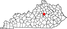 | |
| CDP | ||
| Other unincorporated communities | ||
| Ghost towns | ||
This article is issued from Wikipedia - version of the 7/27/2016. The text is available under the Creative Commons Attribution/Share Alike but additional terms may apply for the media files.