Capixaba, Acre
Coordinates: 10°34′22″S 67°40′33″W / 10.57278°S 67.67583°W
| Capixaba | |
|---|---|
|
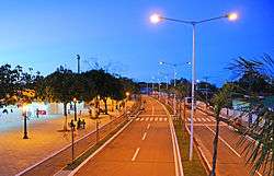
Edmundo Pinto Avenue - Capixaba | |
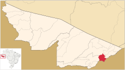 Location of municipality in Acre State | |
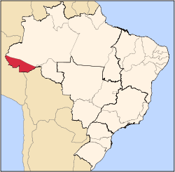
 Capixaba Location in Brazil | |
| Coordinates: 10°34′22″S 67°40′33″W / 10.57278°S 67.67583°W | |
| Country |
|
| State | Acre |
| Area | |
| • Total | 661 sq mi (1,713 km2) |
| Population (2007) | |
| • Total | 8,446 |
Capixaba is a municipality located in the southeast of the Brazilian state of Acre. Its population is 8446 and its area is 1,713 km².
The municipality contains part of the 931,537 hectares (2,301,880 acres) Chico Mendes Extractive Reserve, a sustainable use environmental unit created in 1990.[1]
References
- ↑ Unidade de Conservação: Reserva Extrativista Chico Mendes (in Portuguese), MMA: Ministério do Meio Ambiente, retrieved 2016-06-04
This article is issued from Wikipedia - version of the 6/4/2016. The text is available under the Creative Commons Attribution/Share Alike but additional terms may apply for the media files.