Bethpage, Tennessee
| Bethpage, Tennessee | |
|---|---|
| Census-designated place | |
|
Post office in Bethpage | |
 Bethpage, Tennessee | |
| Coordinates: 36°28′54″N 86°18′43″W / 36.48167°N 86.31194°WCoordinates: 36°28′54″N 86°18′43″W / 36.48167°N 86.31194°W | |
| Country | United States |
| State | Tennessee |
| County | Sumner |
| Area[1] | |
| • Total | 1.328 sq mi (3.44 km2) |
| • Land | 1.328 sq mi (3.44 km2) |
| • Water | 0 sq mi (0 km2) |
| Elevation | 545 ft (166 m) |
| Population (2010)[2] | |
| • Total | 288 |
| • Density | 220/sq mi (84/km2) |
| Time zone | Central (CST) (UTC-6) |
| • Summer (DST) | CDT (UTC-5) |
| Area code(s) | 615 |
| GNIS feature ID | 1277178[3] |
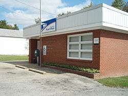
Bethpage is an unincorporated community and census-designated place (CDP) in Sumner County, Tennessee, United States. It is located along U.S. Route 31E, northeast of neighboring Gallatin. As of the 2010 census, its population was 288.[2] The area has its own Post Office. The United States Postal Service ZIP code for the Bethpage area is 37022.[4]
Climate
| Climate data for Bethpage, Tennessee | |||||||||||||
|---|---|---|---|---|---|---|---|---|---|---|---|---|---|
| Month | Jan | Feb | Mar | Apr | May | Jun | Jul | Aug | Sep | Oct | Nov | Dec | Year |
| Average high °F (°C) | 46 (8) |
49 (9) |
59 (15) |
69 (21) |
77 (25) |
86 (30) |
88 (31) |
88 (31) |
83 (28) |
71 (22) |
60 (16) |
48 (9) |
25 (−4) |
| Average low °F (°C) | 27 (−3) |
35 (2) |
44 (7) |
53 (12) |
63 (17) |
66 (19) |
65 (18) |
58 (14) |
44 (7) |
35 (2) |
27 (−3) |
45 (7) |
36 (2) |
| Average precipitation inches (mm) | 4.4 (112) |
4.3 (109) |
5.2 (132) |
4.5 (114) |
5.4 (137) |
4 (100) |
4.4 (112) |
3.4 (86) |
3.6 (91) |
3.2 (81) |
4.3 (109) |
5 (130) |
51.8 (1,316) |
| Source: Weatherbase [5] | |||||||||||||
References
- ↑ "US Gazetteer files: 2010, 2000, and 1990". United States Census Bureau. 2011-02-12. Retrieved 2011-04-23.
- 1 2 "American FactFinder". United States Census Bureau. Archived from the original on 2013-09-11. Retrieved 2011-05-14.
- ↑ "Bethpage". Geographic Names Information System. United States Geological Survey.
- ↑ United States Postal Service (2012). "USPS - Look Up a ZIP Code". Retrieved 2012-02-15.
- ↑ "Weatherbase.com". Weatherbase. 2013. Retrieved on August 11, 2013.
Municipalities and communities of Sumner County, Tennessee, United States | ||
|---|---|---|
| Cities | ||
| Town | ||
| CDPs | ||
| Unincorporated communities | ||
| Footnotes | ‡This populated place also has portions in an adjacent county or counties | |
This article is issued from Wikipedia - version of the 11/1/2016. The text is available under the Creative Commons Attribution/Share Alike but additional terms may apply for the media files.