Batchelor, Louisiana
| Batchelor, Louisiana | |
|---|---|
| Unincorporated community | |
 Batchelor, Louisiana  Batchelor, Louisiana | |
| Coordinates: 30°50′26″N 91°39′41″W / 30.84056°N 91.66139°WCoordinates: 30°50′26″N 91°39′41″W / 30.84056°N 91.66139°W | |
| Country | United States |
| State | Louisiana |
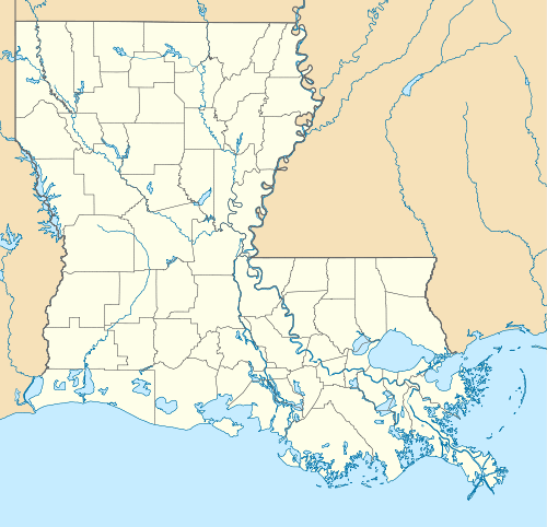
| Parish | Pointe Coupee |
| Elevation | 39 ft (12 m) |
| Time zone | Central (CST) (UTC-6) |
| • Summer (DST) | CDT (UTC-5) |
| ZIP code | 70715 |
| Area code(s) | 225 |
| GNIS feature ID | 553356[1] |
Batchelor is an unincorporated community in Pointe Coupee Parish, Louisiana, United States. The community is located at the intersection of Louisiana Highway 1 and Louisiana Highway 419 near the south bank of the Mississippi River, 8 miles (13 km) north-northwest of Morganza. Batchelor has a post office with ZIP code 70715, which opened on July 26, 1902.[2][3]
References
- ↑ "Batchelor". Geographic Names Information System. United States Geological Survey.
- ↑ United States Postal Service. "USPS - Look Up a ZIP Code". Retrieved May 23, 2015.
- ↑ "Postmaster Finder - Post Offices by ZIP Code". United States Postal Service. Retrieved May 23, 2015.
Municipalities and communities of Pointe Coupee Parish, Louisiana, United States | ||
|---|---|---|
| City | 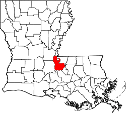 | |
| Towns | ||
| Village | ||
| CDP | ||
| Other unincorporated communities | ||
| Ghost towns | ||
This article is issued from Wikipedia - version of the 7/31/2016. The text is available under the Creative Commons Attribution/Share Alike but additional terms may apply for the media files.