Anilao, Iloilo
| Anilao | ||
|---|---|---|
| Municipality | ||
| ||
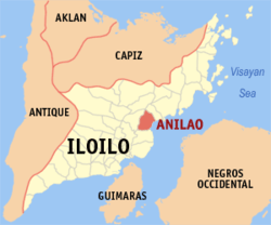 Map of Iloilo with Anilao highlighted | ||
.svg.png) Anilao Location within the Philippines | ||
| Coordinates: 11°00′N 122°43′E / 11.000°N 122.717°ECoordinates: 11°00′N 122°43′E / 11.000°N 122.717°E | ||
| Country | Philippines | |
| Region | Western Visayas (Region VI) | |
| Province | Iloilo | |
| Legislative district | 4th district of Iloilo | |
| Barangays | 21 | |
| Government[1] | ||
| • Mayor | Lee Ann Debuque | |
| Area[2] | ||
| • Total | 100.31 km2 (38.73 sq mi) | |
| Population (2010)[3] | ||
| • Total | 27,486 | |
| • Density | 270/km2 (710/sq mi) | |
| Time zone | PST (UTC+8) | |
| ZIP code | 5009 | |
| Dialing code | 33 | |

Anilao, Iloilo is a fourth class municipality in the province of Iloilo, Philippines. According to the 2010 census, it has a population of 27,486 people.[3]
Barangays
Anilao is politically subdivided into 21 barangays.[2]
- Agbatuan
- Badiang
- Balabag
- Balunos
- Cag-an
- Camiros
- Sambag Culob
- Dangula-an
- Guipis
- Manganese
- Medina
- Mostro
- Palaypay
- Pantalan
- Poblacion
- San Carlos
- San Juan Crisostomo
- Santa Rita
- Santo Rosario
- Serallo
- Vista Alegre
Demographics
| Population census of Anilao | ||
|---|---|---|
| Year | Pop. | ±% p.a. |
| 1990 | 19,560 | — |
| 1995 | 20,711 | +1.08% |
| 2000 | 22,170 | +1.47% |
| 2007 | 23,465 | +0.79% |
| 2010 | 27,486 | +5.92% |
| Source: National Statistics Office[3] | ||
One Town One Product
Anilao markets ginamos under the One Town One Product (OTOP) program.[4]
References
- ↑ "Municipalities". Quezon City, Philippines: Department of the Interior and Local Government. Archived from the original on 25 January 2013. Retrieved 20 February 2013.
- 1 2 "Province: Iloilo". PSGC Interactive. Makati City, Philippines: National Statistical Coordination Board. Archived from the original on 10 May 2013. Retrieved 20 February 2013.
- 1 2 3 "Total Population by Province, City, Municipality and Barangay: as of May 1, 2010" (PDF). 2010 Census of Population and Housing. National Statistics Office. Archived from the original (PDF) on 15 December 2012. Retrieved 20 February 2013.
- ↑ "The Ginamos of Anilao". The News Today. Retrieved August 22, 2011.
External links
- Philippine Standard Geographic Code
- Philippine Census Information
- Local Governance Performance Management System
- Official History of Anilao
 |
San Enrique | Banate | | |
| Dingle | |
Guimaras Strait | ||
| ||||
| | ||||
| Barotac Nuevo |
Iloilo (capital) | |
| Municipalities |
|
| Component city | |
| Highly urbanized city |
|
This article is issued from Wikipedia - version of the 11/30/2016. The text is available under the Creative Commons Attribution/Share Alike but additional terms may apply for the media files.