Angliers, Quebec
| Angliers | |
|---|---|
| Village municipality | |
|
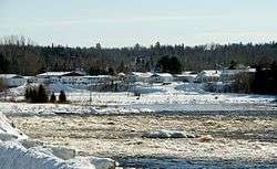
Ottawa River at the outlet of Lac des Quinze, Angliers | |
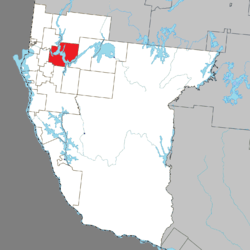 Location within Témiscamingue RCM. | |
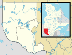 Angliers Location in western Quebec. | |
| Coordinates: 47°32′54″N 79°14′22″W / 47.5482°N 79.2394°WCoordinates: 47°32′54″N 79°14′22″W / 47.5482°N 79.2394°W[1] | |
| Country |
|
| Province |
|
| Region | Abitibi-Témiscamingue |
| RCM | Témiscamingue |
| Settled | 1911 |
| Constituted | May 24, 1945 |
| Named for | Angliers, Vienne[1] |
| Government[2] | |
| • Mayor | Lyna Pine |
| • Federal riding | Abitibi—Témiscamingue |
| • Prov. riding | Rouyn-Noranda–Témiscamingue |
| Area[2][3] | |
| • Total | 382.60 km2 (147.72 sq mi) |
| • Land | 297.32 km2 (114.80 sq mi) |
| Population (2011)[3] | |
| • Total | 298 |
| • Density | 1.0/km2 (3/sq mi) |
| • Pop (2006–11) |
|
| • Dwellings | 209 |
| Time zone | EST (UTC−5) |
| • Summer (DST) | EDT (UTC−4) |
| Postal code(s) | J0Z 1A0 |
| Area code(s) | 819 |
| Census profile | 2485080[3] |
| MAMROT info | 85080[4] |
| Toponymie info | 1464[1] |
Angliers is a village in northwestern Quebec, Canada, in the Témiscamingue Regional County Municipality.
Demographics
Population trend:[5]
- Population in 2011: 298 (2006 to 2011 population change: -3.2 %)
- Population in 2006: 308
- Population in 2001: 331
- Population in 1996: 306
- Population in 1991: 307
Private dwellings occupied by usual residents: 141 (total dwellings: 209)
Mother tongue:[6]
- English as first language: 6.6%
- French as first language: 93.4%
- English and French as first language: 0%
- Other as first language: 0%
See also
References
- 1 2 3 Reference number 1464 of the Commission de toponymie du Québec (French)
- 1 2 "Angliers". Répertoire des municipalités (in French). Ministère des Affaires municipales, des Régions et de l'Occupation du territoire. Retrieved 2010-12-31.
- 1 2 3 "(Code 2485080) Census Profile". 2011 census. Statistics Canada. 2012.
- ↑ Geographic code 85080 in the official Répertoire des municipalités (French)
- ↑ Statistics Canada: 1996, 2001, 2006, 2011 census
- ↑ "Angliers community profile". 2006 Census data. Statistics Canada. Retrieved 2010-12-31.
 |
Guérin | Rémigny | | |
| Saint-Eugène-de-Guigues | |
Moffet | ||
| ||||
| | ||||
| Laverlochère | Fugèreville | Latulipe-et-Gaboury |
| Cities | |
|---|---|
| Municipalities | |
| Townships |
|
| Parishes | |
| Villages | |
| Unorganized territories | |
| |
This article is issued from Wikipedia - version of the 12/25/2015. The text is available under the Creative Commons Attribution/Share Alike but additional terms may apply for the media files.