Angervilliers
| Angervilliers | ||
|---|---|---|
|
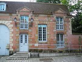
The town hall of Angervilliers | ||
| ||
 Angervilliers | ||
|
Location within Île-de-France region  Angervilliers | ||
| Coordinates: 48°35′31″N 2°03′54″E / 48.592°N 2.0649°ECoordinates: 48°35′31″N 2°03′54″E / 48.592°N 2.0649°E | ||
| Country | France | |
| Region | Île-de-France | |
| Department | Essonne | |
| Arrondissement | Étampes | |
| Canton | Saint-Chéron | |
| Intercommunality | Pays de Limours | |
| Government | ||
| • Mayor (2008–2014) | Roger Cottin | |
| Area1 | 9.01 km2 (3.48 sq mi) | |
| Population (2006)2 | 1,611 | |
| • Density | 180/km2 (460/sq mi) | |
| Time zone | CET (UTC+1) | |
| • Summer (DST) | CEST (UTC+2) | |
| INSEE/Postal code | 91017 / 91470 | |
| Elevation | 77–163 m (253–535 ft) | |
|
1 French Land Register data, which excludes lakes, ponds, glaciers > 1 km² (0.386 sq mi or 247 acres) and river estuaries. 2 Population without double counting: residents of multiple communes (e.g., students and military personnel) only counted once. | ||
.svg.png)
Angervilliers is a commune in the Essonne department in Île-de-France in northern France.
Inhabitants are known as Angervilliérois.
See also
References
External links
| Wikimedia Commons has media related to Angervilliers. |
- Mérimée database - Cultural heritage (French)
- 1999 Land Use (AURIF) (English)
This article is issued from Wikipedia - version of the 10/14/2016. The text is available under the Creative Commons Attribution/Share Alike but additional terms may apply for the media files.