Anahawan, Southern Leyte
| Anahawan | ||
|---|---|---|
| Municipality | ||
| ||
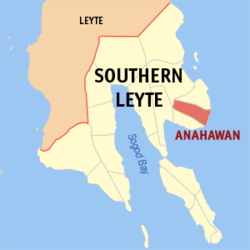 Map of Southern Leyte with Anahawan highlighted | ||
.svg.png) Anahawan Location within the Philippines | ||
| Coordinates: 10°17′N 125°15′E / 10.283°N 125.250°ECoordinates: 10°17′N 125°15′E / 10.283°N 125.250°E | ||
| Country | Philippines | |
| Region | Eastern Visayas (Region VIII) | |
| Province | Southern Leyte | |
| Congr. district | Lone district of S. Leyte | |
| Established | 1930 | |
| Barangays | 14 | |
| Government[1] | ||
| • Mayor | Roberto A. Loquinte | |
| Area[2] | ||
| • Total | 58.09 km2 (22.43 sq mi) | |
| Population (2010)[3] | ||
| • Total | 7,942 | |
| • Density | 140/km2 (350/sq mi) | |
| Time zone | PST (UTC+8) | |
| ZIP code | 6610 | |
| Dialing code | 53 | |

Anahawan is a fifth class municipality in the province of Southern Leyte, Philippines. According to the 2010 census, it has a population of 7,942 people.[3]
Barangays
Anahawan is politically subdivided into 14 barangays.[2]
- Amagusan
- Calintaan
- Canlabian
- Capacuhan
- Kagingkingan
- Lewing
- Lo-ok
- Mahalo
- Mainit
- Manigawong
- Poblacion
- San Vicente
- Tagup-on
- Cogon
Demographics
| Population census of Anahawan | ||
|---|---|---|
| Year | Pop. | ±% p.a. |
| 1990 | 7,063 | — |
| 1995 | 6,471 | −1.63% |
| 2000 | 7,209 | +2.34% |
| 2007 | 8,032 | +1.50% |
| 2010 | 7,942 | −0.41% |
| Source: National Statistics Office[3] | ||
References
- ↑ "Municipalities". Quezon City, Philippines: Department of the Interior and Local Government. Archived from the original on 31 May 2013. Retrieved 8 July 2013.
- 1 2 "Province: Southern Leyte". PSGC Interactive. Makati City, Philippines: National Statistical Coordination Board. Retrieved 10 July 2013.
- 1 2 3 "Total Population by Province, City, Municipality and Barangay: as of May 1, 2010" (PDF). 2010 Census of Population and Housing. National Statistics Office. Archived from the original (PDF) on 20 March 2013. Retrieved 10 July 2013.
External links
- Philippine Standard Geographic Code
- Philippine Census Information
- Local Governance Performance Management System
 |
Hinunangan | Hinundayan | | |
| Saint Bernard | |
Surigao Strait | ||
| ||||
| | ||||
| San Juan |
This article is issued from Wikipedia - version of the 10/12/2016. The text is available under the Creative Commons Attribution/Share Alike but additional terms may apply for the media files.