Ørteren
| Ørteren | |
|---|---|
| Location | Hol (Buskerud) |
| Coordinates | 60°28′13″N 7°47′43″E / 60.47028°N 7.79528°E / 60.47028; 7.79528Coordinates: 60°28′13″N 7°47′43″E / 60.47028°N 7.79528°E / 60.47028; 7.79528 |
| Basin countries | Norway |
| Surface area | 10.46 km² |
| Shore length1 | 31.49 km |
| Surface elevation | 1,147 m |
| References | NVE |
| 1 Shore length is not a well-defined measure. | |
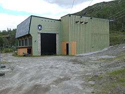
Ørteren kraftverk
Ørteren is a lake in the municipality of Hol in Buskerud county, Norway.
Ørteren is located in Hardangervidda. Norwegian National Road 7 runs along the east side of the Lake. Ørteren is regulated for Ørteren Kraftverk. a hydroelectric power plant at Haugastøl. The power plant utilizes a drop of 160 meters between Ørteren and Sløtfjorden. It went into production in 1966. The dam and the intake were built by Oslo Energi and are currently operated by E- CO. [1] [2] [3]
References
See also
This article is issued from Wikipedia - version of the 9/4/2015. The text is available under the Creative Commons Attribution/Share Alike but additional terms may apply for the media files.