Yangdok County
| Yangdŏk County 양덕군 | |
|---|---|
| County | |
| Korean transcription(s) | |
| • Chosŏn'gŭl | 양덕군 |
| • Hancha | 陽德郡 |
| • McCune-Reischauer | Yangdŏk-kun |
| • Revised Romanization | Yangdeok-gun |
 | |
| Country | North Korea |
| Province | South P'yŏngan |
| Administrative divisions | 1 ŭp, 18 ri |
| Area | |
| • Total | 772 km2 (298 sq mi) |
| Population (2008[1]) | |
| • Total | 61,355 |
| • Density | 79/km2 (210/sq mi) |
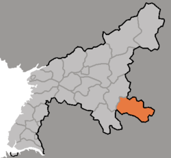
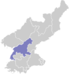
Yangdŏk County is a kun (county) in South P'yŏngan province, North Korea.
Administrative Divisions
Yangdŏk County is divided into one ŭp (town) and 18 ri (villages):
|
|
Transportation
Yangdŏk county is served by the P'yŏngra Line of the Korean State Railway.
References
- ↑ Korean Central Bureau of Statistics: 2008 Population Census (Population 2008, published in 2009)
External links
- (English) Map of Pyongan provinces
- (Korean) Detailed map
This article is issued from Wikipedia - version of the 12/22/2015. The text is available under the Creative Commons Attribution/Share Alike but additional terms may apply for the media files.