Yanchengpu Station
Yanchengpu 鹽埕埔 | |
|---|---|
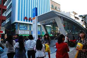 Yanchengpu Station Exit 3 | |
| Location |
Gushan, Kaohsiung Taiwan |
| Operated by | |
| Line(s) |
|
| Platforms | 1 island platform |
| Connections | Bus stop |
| Construction | |
| Structure type | Underground |
| Disabled access | Yes |
| History | |
| Opened | September 14, 2008 |
| Traffic | |
| Passengers | 6,023 daily (Jan. 2011)[1] |
| Yanchengpu Station | |||||||||||||||||
| Traditional Chinese | 鹽埕埔車站 | ||||||||||||||||
|---|---|---|---|---|---|---|---|---|---|---|---|---|---|---|---|---|---|
| Simplified Chinese | 盐埕埔车站 | ||||||||||||||||
| |||||||||||||||||
The Kaohsiung MRT Yanchengpu Station is a station on the Orange Line in Gushan District, Kaohsiung, Taiwan.
Station overview
The station is a two-level, underground station with an island platform and four exits.[2] The station is 288 metres (945 ft) long and is at the intersection of Dayong Road and Wufu 4th Road.[3]
Station layout
| Street Level | Entrance/Exit | Entrance/Exit |
| B1 | Concourse | Lobby, information desk, automatic ticket machines, one-way faregates, Restrooms (Near Exits 1) |
| B2 | Platform 1 | ← KMRT Orange Line toward Sizihwan (Terminus) |
| Platform 2 | → KMRT Orange Line toward Daliao (City Council) → | |
Exits
- Exit 1: Yancheng Elementary School, Shinkuchan Shopping District
- Exit 2: Kaohsiung Museum of History, Kaohsiung Business Exhibition Center

- Exit 3: Yancheng Junior High School
- Exit 4: Jhongsiao Elementary School
Around the station
- International Convention Center Kaohsiung
- Kaohsiung City Music Hall
- Kaohsiung Film Archive
- Kaohsiung Museum of History
- Love Pier
- Love River
- Shinkuchan Shopping District
- Kaohsiung Business Exhibition Center
- Kaohsiung Bridge
Nearby stations
| Preceding station | Kaohsiung MRT | Following station | ||
|---|---|---|---|---|
Terminus | Orange Line | toward Daliao |
References
| Wikimedia Commons has media related to Yanchengpu Station. |
- ↑ "統計資訊 > 統計月報". Transportation Bureau, Kaohsiung City Government. Retrieved 2011-02-15.
- ↑ "鹽埕埔站". 高雄捷運公司. Retrieved 2010-07-05.
- ↑ "鹽埕埔站週邊地圖". 高雄捷運公司. Retrieved 2010-07-05.
Coordinates: 22°37′27″N 120°17′03″E / 22.62417°N 120.28417°E
This article is issued from Wikipedia - version of the 11/4/2016. The text is available under the Creative Commons Attribution/Share Alike but additional terms may apply for the media files.