Wittewater
| Wittewater | |
|---|---|
 Wittewater 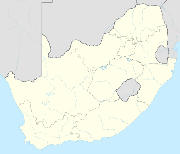 Wittewater  Wittewater
| |
| Coordinates: 32°54′55″S 18°42′07″E / 32.915278°S 18.702°ECoordinates: 32°54′55″S 18°42′07″E / 32.915278°S 18.702°E | |
| Country | South Africa |
| Province | Western Cape |
| District | West Coast |
| Municipality | Bergrivier |
| Area[1] | |
| • Total | 0.48 km2 (0.19 sq mi) |
| Population (2011)[1] | |
| • Total | 848 |
| • Density | 1,800/km2 (4,600/sq mi) |
| Racial makeup (2011)[1] | |
| • Black African | 1.9% |
| • Coloured | 98.0% |
| • Indian/Asian | 0.1% |
| First languages (2011)[1] | |
| • Afrikaans | 97.5% |
| • English | 1.7% |
| • Other | 0.8% |
| PO box | 7322 |
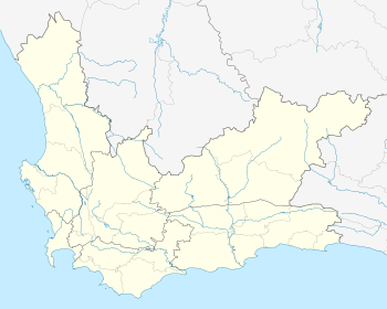
Wittewater is a town in Bergrivier Local Municipality in the Western Cape province of South Africa, located off the R399 road, between Piketberg and Velddrif.[2] It was established in the 1857 by German Moravian missionaries.[3]
The name, "white water", refers to the waterfall behind the town occasionally created by abundant winter rain.[3]
References
- 1 2 3 4 "Main Place Wittewater". Census 2011.
- ↑ "Wittewater". SA Places. Retrieved 29 August 2014.
- 1 2 Karena Du Plessis; Vanessa Cowling (2006-01-01). West Coast: Landscape, People, Food, Texture. Struik. p. 106. ISBN 978-1-77007-188-9.
Municipalities and communities of West Coast District Municipality, Western Cape | ||
|---|---|---|
District seat: Moorreesburg | ||
| Matzikama | .svg.png) | |
| Cederberg | ||
| Bergrivier | ||
| Saldanha Bay | ||
| Swartland | ||
This article is issued from Wikipedia - version of the 11/4/2016. The text is available under the Creative Commons Attribution/Share Alike but additional terms may apply for the media files.