Winnemucca Mountain
| Winnemucca Mountain | |
|---|---|
_in_Winnemucca%2C_Nevada-cropped.jpg) View towards Winnemucca Mountain from Nevada State Route 794 in Winnemucca | |
| Highest point | |
| Elevation | 6742+ ft (2055+ m) [1] |
| Prominence | 1,919 ft (585 m) [1] |
| Coordinates | 41°00′39″N 117°46′03″W / 41.010911008°N 117.767582942°WCoordinates: 41°00′39″N 117°46′03″W / 41.010911008°N 117.767582942°W [2] |
| Geography | |
 Winnemucca Mountain Nevada, U.S. | |
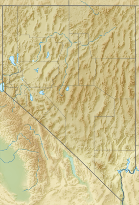
| Location | Humboldt County, Nevada, U.S. |
| Parent range | Santa Rosa Range |
Winnemucca Mountain is a mountain near the small city of Winnemucca in Humboldt County, Nevada, United States. It is considered to be the southernmost named summit of the Santa Rosa Range.[3] A paved road ascends to radio facilities on the summit.
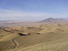
View north-northwest from the summit
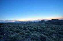
Sunset from the Winnemucca Mountain Road.
References
- 1 2 "Winnemucca Mountain". Peakbagger.com. Retrieved 2014-01-28.
- ↑ "Winnemucca". NGS data sheet. U.S. National Geodetic Survey. Retrieved 2014-01-30.
- ↑ "Santa Rosa Santa Rosa Mountains". Peakbagger.com. Retrieved 2014-01-28.
| Wikimedia Commons has media related to Winnemucca Mountain. |
This article is issued from Wikipedia - version of the 2/18/2016. The text is available under the Creative Commons Attribution/Share Alike but additional terms may apply for the media files.