Wilson Island (Ritchie's Archipelago)
| Nickname: Sir Archdale Wilson Island | |
|---|---|
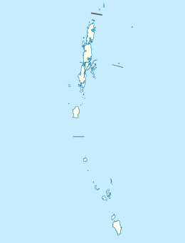
 Wilson Island  Wilson Island Location of Wilson Island | |
| Geography | |
| Location | Bay of Bengal |
| Coordinates | 12°08′N 92°59′E / 12.13°N 92.98°ECoordinates: 12°08′N 92°59′E / 12.13°N 92.98°E |
| Archipelago | Andaman Islands |
| Adjacent bodies of water | Indian Ocean |
| Total islands | 1 |
| Major islands |
|
| Area | 14.3 km2 (5.5 sq mi)[1] |
| Length | 4.1 km (2.55 mi) |
| Width | 4.3 km (2.67 mi) |
| Coastline | 16.2 km (10.07 mi) |
| Highest elevation | 216 m (709 ft)[2] |
| Highest point | Round Hill |
| Administration | |
| District | South Andaman |
| Island group | Andaman Islands |
| Island sub-group | Ritchie's Archipelago |
| Tehsil | Port Blair Tehsil |
Largest settlement | |
| Demographics | |
| Demonym | Hindi |
| Population | 0 (2011) |
| Pop. density | 0.00 /km2 (0 /sq mi) |
| Ethnic groups | Hindu, Andamanese |
| Additional information | |
| Time zone | |
| PIN | 744202[3] |
| Telephone code | 031927 [4] |
| Official website |
www |
| ISO Code | IN-AN-00[5] |
| Literacy | 84.4% |
| Avg. summer temperature | 30.2 °C (86.4 °F) |
| Avg. winter temperature | 23.0 °C (73.4 °F) |
| Sex ratio | 1.2♂/♀ |
| unit_pref | Metric |
| Census Code | 35.639.0004 |
| Official Languages | Hindi, English |
Wilson Island is an island of the Andaman Islands. It belongs to the South Andaman administrative district, part of the Indian union territory of Andaman and Nicobar Islands.[6] the island is lying 57 km (35 mi) northeast from Port Blair.
Etymology
Wilson is named after Brigadier Commander Sir Archdale Wilson.
History
The establishment of a lighted beacon on Wilson Island was over due. It was during 1993-94 that the G.I. trestle was erected on the North-West shore of the island and the modern solar powered equipment from ‘Tide land’ of USA was installed over the trestle tower. The lighthouse was commissioned on 23 March 1994.[7] the lighthouse is accessible only by boat.
Geography
The island belongs to the Ritchie's Archipelago and is located between Nicholson Island and John Lawrence Island. a narrow channel (400 m (1,312 ft)) separates it from Sir William Peel Island to the south.
Administration
Politically, Wilson Island is part of Port Blair Taluk.[8]
Demographics
The island is uninhabited.
Image gallery
 Outline map of the Andaman Islands, with Ritchie's Archipelago highlighted (in red).
References
- ↑ "Islandwise Area and Population - 2011 Census" (PDF). Government of Andaman.
- ↑ "Sailing Directions (enroute) | India and the Bay of Bengal" (PDF) (173). National Geospatial-intelligence Agency, United States Government. 2014. Retrieved 2016-09-23.
- ↑ "A&N Islands - Pincodes". 22 September 2016. Retrieved 22 September 2016.
- ↑ "STD Codes of Andaman and Nicobar". allcodesindia.in. Retrieved 2016-09-23.
- ↑ Registration Plate Numbers added to ISO Code
- ↑ "Village Code Directory: Andaman & Nicobar Islands" (PDF). Census of India. Retrieved 2011-01-16.
- ↑ "Government of India, Directorate General of Lighthouses and Lightships.". www.dgll.nic.in. Retrieved 2016-10-18.
- ↑ "DEMOGRAPHIC – A&N ISLANDS" (PDF). andssw1.and.nic.in. Retrieved 2016-09-23.
| Wikimedia Commons has media related to Ritchie's Archipelago. |
 Ritchie's Archipelago travel guide from Wikivoyage