Westerlee, South Holland
| Westerlee | |
|---|---|
| Hamlet | |
|
Westerlee | |
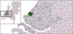 | |
 Westerlee in the municipality of Westland. | |
| Coordinates: 51°58′23″N 4°13′16″E / 51.97306°N 4.22111°ECoordinates: 51°58′23″N 4°13′16″E / 51.97306°N 4.22111°E | |
| Country | Netherlands |
| Province | South Holland |
| Municipality | Westland |
| Area | |
| • Total | 0.26 km2 (0.10 sq mi) |
| Population (2008) | |
| • Total | 80 |
| • Density | 310/km2 (800/sq mi) |
| Time zone | CET (UTC+1) |
| • Summer (DST) | CEST (UTC+2) |
Westerlee is a hamlet in the Dutch province of South Holland. It is a part of the municipality of Westland, and lies about 5 km north of Maassluis.
The statistical area "Westerlee", which also can include the surrounding countryside, has a population of around 70.[1]
.svg.png)
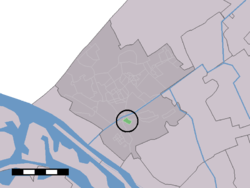
Locatie van Westerlee binnen de gemeente Westland
References
- ↑ Statistics Netherlands (CBS), Statline: Kerncijfers wijken en buurten 2003-2005. As of 1 January 2005.
This article is issued from Wikipedia - version of the 3/28/2014. The text is available under the Creative Commons Attribution/Share Alike but additional terms may apply for the media files.