West Elk Mountains
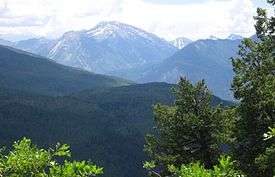
The West Elk Mountains are a high mountain range in the west-central part of the U.S. state of Colorado. They lie primarily within the Gunnison National Forest, and part of the range is protected as the West Elk Wilderness. The range is primarily located in Gunnison County, with small parts in eastern Delta and Montrose counties.
The West Elks are surrounded by tributaries of the Gunnison River. The range is bounded on the north by the North Fork of the Gunnison and on the east by the East River, another tributary of the Gunnison. On the south and west it is contiguous with Black Mesa and Fruitland Mesa, both part of the uplift in which sits the Black Canyon of the Gunnison. On the northeast it is contiguous with the Elk Mountains, being separated from them by Anthracite Creek and Coal Creek. Nearby towns include Gunnison, Paonia, and the ski resort of Crested Butte.
Prominent peaks
.jpg)
| Rank | Mountain Peak | Elevation | Prominence | Isolation |
|---|---|---|---|---|
| 1 | West Elk Peak NGS PB | 13,042 feet 3975 m |
3,095 feet 943 m |
13.8 miles 22.2 km |
| 2 | Mount Gunnison NGS PB | 12,725 feet 3879 m |
3,549 feet 1082 m |
11.8 miles 19.1 km |
| 3 | Whetstone Mountain NGS PB | 12,527 feet 3818 m |
2,456 feet 749 m |
9.4 miles 15.1 km |
| 4 | East Beckwith Mountain NGS PB | 12,441 feet 3792 m |
2,492 feet 760 m |
6.8 miles 11.0 km |
| 5 | Anthracite Peak NGS PB | 12,394 feet 3778 m |
2,125 feet 648 m |
4.8 miles 7.7 km |
| 6 | Carbon Peak NGS PB | 12,088 feet 3684 m |
2,179 feet 664 m |
3.9 miles 6.3 km |
| 7 | Mount Guero NGS PB | 12,058 feet 3675 m |
2,432 feet 741 m |
6.4 miles 10.3 km |
| 8 | Marcellina Mountain[1] PB | 11,353 feet 3461 m |
2,728 feet 831 m |
5.1 miles 8.2 km |
References
- ↑ The elevation of this summit has been converted from the National Geodetic Vertical Datum of 1929 (NGVD 29) to the North American Vertical Datum of 1988 (NAVD 88). National Geodetic Survey
External links
- West Elk Mountains on peakbagger.com
- Topographic map from USGS The National Map
- Geology of the Elk Mountains
- U.S. Geological Survey Geographic Names Information System: West Elk Mountains
- West Elk Mountains on TopoQuest

Coordinates: 38°43′13″N 107°11′56″W / 38.72028°N 107.19889°W