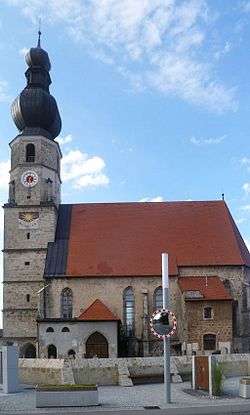
Weng im Innkreis
| Weng im Innkreis | ||
|---|---|---|
 | ||
| ||
 Weng im Innkreis Location within Austria | ||
| Coordinates: 48°14′09″N 13°10′47″E / 48.23583°N 13.17972°ECoordinates: 48°14′09″N 13°10′47″E / 48.23583°N 13.17972°E | ||
| Country | Austria | |
| State | Upper Austria | |
| District | Braunau am Inn | |
| Government | ||
| • Mayor | Josef Moser (ÖVP) | |
| Area | ||
| • Total | 21.34 km2 (8.24 sq mi) | |
| Elevation | 370 m (1,210 ft) | |
| Population (14 June 2016)[1] | ||
| • Total | 1,378 | |
| • Density | 65/km2 (170/sq mi) | |
| Time zone | CET (UTC+1) | |
| • Summer (DST) | CEST (UTC+2) | |
| Postal codes | 4952 (Weng im Innkreis), 4950 (Altheim), 4961 (Mühlheim am Inn) | |
| Area code | 07723 | |
| Vehicle registration | BR | |
| Website | www.weng-innkreis.at | |
Weng im Innkreis is a municipality in the district of Braunau am Inn in the Austrian state of Upper Austria.
Geography
Weng lies on the western edge of the Innviertel hills. About 8 percent of the municipality is forest and 83 percent farmland.
Neighboring municipalities
| Sankt Peter am Hart | Mining | Mühlheim am Inn | |
| |
Altheim | ||
| |||
| | |||
| Burgkirchen | Moosbach |

References
| Wikimedia Commons has media related to Weng im Innkreis. |
This article is issued from Wikipedia - version of the 10/14/2016. The text is available under the Creative Commons Attribution/Share Alike but additional terms may apply for the media files.