Unterpremstätten
| Unterpremstätten | ||
|---|---|---|
| ||
 Unterpremstätten Location within Austria | ||
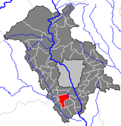
Location within Graz-Umgebung district
| ||
| Coordinates: 46°57′53″N 15°24′15″E / 46.96472°N 15.40417°ECoordinates: 46°57′53″N 15°24′15″E / 46.96472°N 15.40417°E | ||
| Country | Austria | |
| State | Styria | |
| District | Graz-Umgebung | |
| Government | ||
| • Mayor | Anton Scherbinek | |
| Area | ||
| • Total | 17.77 km2 (6.86 sq mi) | |
| Elevation | 351 m (1,152 ft) | |
| Population (1 January 2016)[1] | ||
| • Total | 3,964 | |
| • Density | 220/km2 (580/sq mi) | |
| Time zone | CET (UTC+1) | |
| • Summer (DST) | CEST (UTC+2) | |
| Postal code | 8141 | |
| Area codes | 0 31 36 | |
| Vehicle registration | GU | |
| Website | www.unterpremstaetten.at | |

Unterpremstätten is a former municipality in the district of Graz-Umgebung in the Austrian state of Styria. Since the 2015 Styria municipal structural reform, it is part of the municipality Premstätten.[2]
It is perhaps most famous as the location of AMS formerly known as austriamicrosystems.
Population
| Historical population | ||
|---|---|---|
| Year | Pop. | ±% |
| 1869 | 949 | — |
| 1890 | 1,048 | +10.4% |
| 1900 | 1,098 | +4.8% |
| 1910 | 1,321 | +20.3% |
| 1923 | 1,246 | −5.7% |
| 1934 | 1,581 | +26.9% |
| 1939 | 1,661 | +5.1% |
| 1951 | 1,812 | +9.1% |
| 1961 | 1,966 | +8.5% |
| 1971 | 2,058 | +4.7% |
| 1981 | 2,129 | +3.4% |
| 1991 | 2,574 | +20.9% |
| 2001 | 3,188 | +23.9% |
| 2011 | 3,605 | +13.1% |
References
This article is issued from Wikipedia - version of the 11/22/2016. The text is available under the Creative Commons Attribution/Share Alike but additional terms may apply for the media files.