Toraghundi
| Toraghundi | |
|---|---|
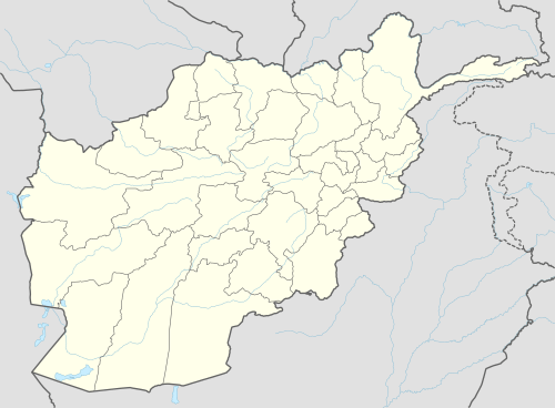 Toraghundi Location in Afghanistan | |
| Coordinates: 35°15′N 62°17′E / 35.250°N 62.283°E | |
| Country |
|
| Province | Herat Province |
| District | Kushk District |
| Elevation | 2,224 ft (678 m) |
| Time zone | + 4.30 |
Toraghundi (Pashto: توره غونډۍ), also Torghundi or Towraghondi, is a border town in Afghanistan. It is immediately opposite to Serhetabat in Turkmenistan, with which it is connected by a road and a 1520 mm gauge railway which was restored to use in 2007.[1]
The single railtrack was built in 1960.[2]
Climate
With an influence from the local steppe climate, Toraghundi features a cold semi-arid climate (BSk) under the Köppen climate classification. The average temperature in Toraghundi is 15.8 °C, while the annual precipitation averages 300 mm.
July is the hottest month of the year with an average temperature of 28.5 °C. The coldest month January has an average temperature of 3.4 °C.
| Climate data for Toraghundi | |||||||||||||
|---|---|---|---|---|---|---|---|---|---|---|---|---|---|
| Month | Jan | Feb | Mar | Apr | May | Jun | Jul | Aug | Sep | Oct | Nov | Dec | Year |
| Average high °C (°F) | 9.0 (48.2) |
10.4 (50.7) |
16.4 (61.5) |
22.5 (72.5) |
29.4 (84.9) |
34.6 (94.3) |
36.7 (98.1) |
35.1 (95.2) |
30.8 (87.4) |
24.8 (76.6) |
17.3 (63.1) |
11.6 (52.9) |
23.22 (73.78) |
| Daily mean °C (°F) | 3.4 (38.1) |
4.8 (40.6) |
10.0 (50) |
15.5 (59.9) |
21.2 (70.2) |
26.0 (78.8) |
28.5 (83.3) |
26.8 (80.2) |
21.7 (71.1) |
16.0 (60.8) |
9.7 (49.5) |
5.5 (41.9) |
15.76 (60.37) |
| Average low °C (°F) | −2.2 (28) |
−0.7 (30.7) |
3.7 (38.7) |
8.6 (47.5) |
13.0 (55.4) |
17.4 (63.3) |
20.4 (68.7) |
18.5 (65.3) |
12.7 (54.9) |
7.3 (45.1) |
2.2 (36) |
−0.5 (31.1) |
8.37 (47.06) |
| Source: Climate-Data.org[3] | |||||||||||||
See also
- Islam Qala
- Hairatan
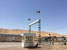 Toraghundi border to Turkmenistan, Afghan side. July 2015.
 - Shir Khan Bandar
- Demogan
- Spin Boldak
- Torkham
- Transport in Afghanistan
References
- ↑ "Afghan rebuild underway". Railway Gazette International. July 12, 2007.
- ↑ Hamid Wahed Alikuzai A Concise History of Afghanistan in 25 Volumes, Volume 1 at Google Books
- ↑ "Climate: Towrgondi - Climate-Data.org". Retrieved 9 September 2016.
External links
Coordinates: 35°15′N 62°17′E / 35.250°N 62.283°E
| Capital | 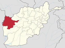 | |
|---|---|---|
| Districts | ||
| Cities | ||
| Landmarks |
| |