Tillabéri
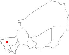
Tillabéri (var. Tillabéry) is a town in northwest Niger. It is situated 113 km northwest of the capital Niamey on the River Niger.[1] It is an important market town and administrative center, it is capital of the department of Tillabéri and Tillabéri Region. The town had a population of over 16000 at the 2001 census.[2] The area was home to giraffe herds until the 1980s.
Climate
| Climate data for Tillaberi (1961-1990) | |||||||||||||
|---|---|---|---|---|---|---|---|---|---|---|---|---|---|
| Month | Jan | Feb | Mar | Apr | May | Jun | Jul | Aug | Sep | Oct | Nov | Dec | Year |
| Average high °C (°F) | 32.3 (90.1) |
35.6 (96.1) |
38.9 (102) |
41.4 (106.5) |
41.5 (106.7) |
38.8 (101.8) |
35.4 (95.7) |
33.7 (92.7) |
35.6 (96.1) |
38.4 (101.1) |
36.4 (97.5) |
33.0 (91.4) |
36.75 (98.14) |
| Daily mean °C (°F) | 24.6 (76.3) |
27.5 (81.5) |
30.9 (87.6) |
33.6 (92.5) |
34.7 (94.5) |
32.7 (90.9) |
30.2 (86.4) |
28.9 (84) |
30.1 (86.2) |
31.2 (88.2) |
28.4 (83.1) |
25.3 (77.5) |
29.84 (85.73) |
| Average low °C (°F) | 17.0 (62.6) |
19.4 (66.9) |
22.8 (73) |
25.9 (78.6) |
27.9 (82.2) |
26.7 (80.1) |
24.9 (76.8) |
24.1 (75.4) |
24.5 (76.1) |
23.9 (75) |
20.4 (68.7) |
17.5 (63.5) |
22.92 (73.24) |
| Average precipitation mm (inches) | 0.0 (0) |
0.0 (0) |
2.3 (0.091) |
5.6 (0.22) |
16.6 (0.654) |
46.8 (1.843) |
102.7 (4.043) |
143.1 (5.634) |
69.9 (2.752) |
10.8 (0.425) |
0.3 (0.012) |
0.1 (0.004) |
398.2 (15.678) |
| Mean monthly sunshine hours | 285.2 | 260.4 | 269.7 | 246.0 | 272.8 | 255.0 | 248.0 | 235.6 | 249.0 | 279.0 | 279.0 | 279.0 | 3,175.5 |
| Source: NOAA [3] | |||||||||||||
References
- ↑ Tillaberi, Niger Page. Falling Rain Genomics, Inc. 1996-2004
- ↑ Niger: largest cities and towns and statistics of their population. World Gazetteer.
- ↑ "Tillabery Climate Normals". National Oceanic and Atmospheric Administration. Retrieved April 9, 2016.
- Decalo, Samuel (1997). Historical Dictionary of the Niger (3rd ed.). Boston & Folkestone: Scarecrow Press. ISBN 0-8108-3136-8.
- Geels, Jolijn (2006). Niger. Chalfont St Peter, Bucks / Guilford, CT: Bradt UK / Globe Pequot Press. ISBN 978-1-84162-152-4.
Coordinates: 14°13′N 1°27′E / 14.217°N 1.450°E
This article is issued from Wikipedia - version of the 9/19/2016. The text is available under the Creative Commons Attribution/Share Alike but additional terms may apply for the media files.