Thattamala
| Thattamala തട്ടാമല | |
|---|---|
| Neighbourhood | |
|
National Highway-66 at Thattamala | |
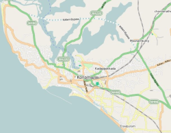 Thattamala Location in Kerala, India | |
| Coordinates: 8°52′18″N 76°38′20″E / 8.871725°N 76.639020°ECoordinates: 8°52′18″N 76°38′20″E / 8.871725°N 76.639020°E | |
| Country |
|
| State | Kerala |
| District | Kollam |
| Government | |
| • Body | Kollam Municipal Corporation(KMC) |
| Languages | |
| • Official | Malayalam, English |
| Time zone | IST (UTC+5:30) |
| PIN | 691020 |
| Vehicle registration | KL-02 |
| Lok Sabha constituency | Kollam |
| Civic agency | Kollam Municipal Corporation |
| Avg. summer temperature | 34 °C (93 °F) |
| Avg. winter temperature | 22 °C (72 °F) |
| Website | http://www.kollam.nic.in |
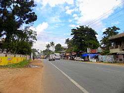
Thattamala (Malayalam: തട്ടാമല) is a neighbourhood situated at the southeast border of Kollam city in state of Kerala, India. It is situated at National Highways – NH 66 (Earlier NH 47). Kerala Police have identified Thattamala as one of the traffic black spots in the state.[1]
Thattamala was a part of old Vadakkevila panchayath before the constitution of Kollam as a city. In 2000, Kollam was upgraded by the Government of Kerala as the 4th Municipal Corporation of Kerala by merging Vadakkevila, Kilikollur, Sakthikulangara and Eravipuram panchayaths with Kollam Municipality.[2]
Major Public/Private Institutions near Thattamala
- Travancore Medicity Medical College Hospital
- Canara Bank Thattamala branch
- Govt. LP School, Eravipuram
- Sarathy Bajaj
- KTM Kollam
- Popular Megamotors
- Sree Narayana Public School[3]
- Dimos Furniture
- Damro Furniture
- Himalaya Chitty Limited[4]
See also
- Kollam
- Mevaram
- Kollam Junction railway station
- Travancore Medical College Hospital, Kollam
- Kollam Bypass
References
This article is issued from Wikipedia - version of the 12/1/2016. The text is available under the Creative Commons Attribution/Share Alike but additional terms may apply for the media files.