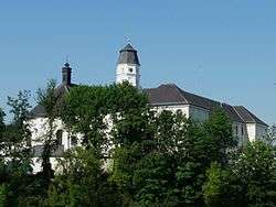
Suben
| Suben | ||
|---|---|---|
 | ||
| ||
 Suben Location within Austria | ||
| Coordinates: 48°25′00″N 13°26′00″E / 48.41667°N 13.43333°ECoordinates: 48°25′00″N 13°26′00″E / 48.41667°N 13.43333°E | ||
| Country | Austria | |
| State | Upper Austria | |
| District | Schärding | |
| Government | ||
| • Mayor | Ernst Johann Seitz (ÖVP) | |
| Area | ||
| • Total | 6.41 km2 (2.47 sq mi) | |
| Elevation | 329 m (1,079 ft) | |
| Population (14 June 2016)[1] | ||
| • Total | 1,504 | |
| • Density | 230/km2 (610/sq mi) | |
| Time zone | CET (UTC+1) | |
| • Summer (DST) | CEST (UTC+2) | |
| Postal code | 4975 | |
| Area code | 07711 | |
| Vehicle registration | SD | |
| Website | www.suben.at | |
Suben is a municipality in the district of Schärding in the Austrian state of Upper Austria. It is not far from the Austrian-German border.
Geography
Suben lies in the Innviertel. About 13 percent of the municipality is forest, and 58 percent is farmland.
References
| Wikimedia Commons has media related to Suben. |
This article is issued from Wikipedia - version of the 8/13/2015. The text is available under the Creative Commons Attribution/Share Alike but additional terms may apply for the media files.