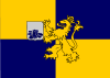
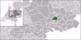
Steenderen
| Steenderen | |||
|---|---|---|---|
| |||
| Coordinates: 52°3′52″N 6°11′12″E / 52.06444°N 6.18667°E | |||
| Country | Netherlands | ||
| Province | Gelderland | ||
| Municipality | Bronckhorst | ||

|
| |
| Country | Netherlands |
| Province | Gelderland |
| Area - Land - Water |
50.23 km² 48.73 km² 1.50 km² |
| Population (2004) - Density |
5,087 104/km² |
Steenderen is a former municipality and a town in the eastern Netherlands.
Population centres
- Baak
- Bronkhorst
- Olburgen
- Rha
- Steenderen
- Toldijk
Gallery
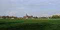 Steenderen, view to the village with two church towers
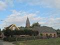 Steenderen, church (de Sint Remigiuskerk) in the street
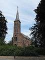 Steenderen, church: de Sint Willibrorduskerk
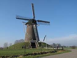 between Steenderen and Bronkhorst, Bronkhorstermolen windmill
External links
Coordinates: 52°04′N 6°11′E / 52.067°N 6.183°E
This article is issued from Wikipedia - version of the 2/13/2015. The text is available under the Creative Commons Attribution/Share Alike but additional terms may apply for the media files.