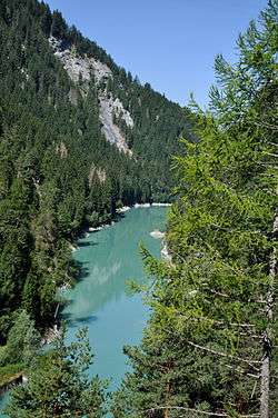
Stausee Solis
| Stausee Solis | |
|---|---|
 View from the Rhaetian Railway line | |
| Location | Alvaschein/Stierva/Tiefencastel, Graubünden |
| Coordinates | 46°40′25″N 9°32′38″E / 46.67361°N 9.54389°ECoordinates: 46°40′25″N 9°32′38″E / 46.67361°N 9.54389°E |
| Type | reservoir |
| Primary inflows | Albula |
| Primary outflows | Albula |
| Basin countries | Switzerland |
| Surface area | 0.1775 km² |
| Surface elevation | 824 m (2,703 ft) |
| References | Swisstopo[1] |
The Stausee Solis ("Solis reservoir") is a reservoir on the Albula river, located between Alvaschein, Stierva and Tiefencastel, in the canton of Graubünden. Its surface area is 0.1775 km².
The dam is located just east of the Solis Viaduct of the Albula Railway.
References
- ↑ VECTOR25 Primary surfaces (Federal Office of Topography swisstopo). Retrieved 2014-06-29.
This article is issued from Wikipedia - version of the 9/6/2015. The text is available under the Creative Commons Attribution/Share Alike but additional terms may apply for the media files.