Sioule
| Sioule | |
|---|---|
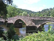 The bridge over the Sioule in Menat. | |
| Country | France |
| Basin | |
| Main source |
Massif Central 1,090 m (3,580 ft) |
| River mouth |
Allier 222 m (728 ft) 46°21′57″N 3°19′11″E / 46.36583°N 3.31972°ECoordinates: 46°21′57″N 3°19′11″E / 46.36583°N 3.31972°E |
| Progression | Allier→ Loire→ Atlantic Ocean |
| Basin size | 2,468 km2 (953 sq mi) |
| Physical characteristics | |
| Length | 167 km (104 mi) |
| Discharge |
|
The Sioule is a 167 kilometres (104 mi) long river in central France, left tributary of the river Allier. Its source is near the village Orcival, north of Mont-Dore, in the Massif Central. The Sioule has cut a deep gorge, especially in its upper course. The Sioule flows generally northeast through the following départements and towns:
The Sioule (in the Central of France ) flows into the river Allier at La Ferté-Hauterive, 10 km (6 mi) north of Saint-Pourçain-sur-Sioule.
Its main tributaries are the Sioulet and the Bouble.
The Fades viaduct, the tallest bridge in France, is located on the Sioule.
References
| Wikimedia Commons has media related to Sioule. |
This article is issued from Wikipedia - version of the 6/11/2016. The text is available under the Creative Commons Attribution/Share Alike but additional terms may apply for the media files.