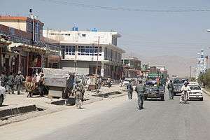
Sharana
| Sharana ښرنه | |
|---|---|
 | |
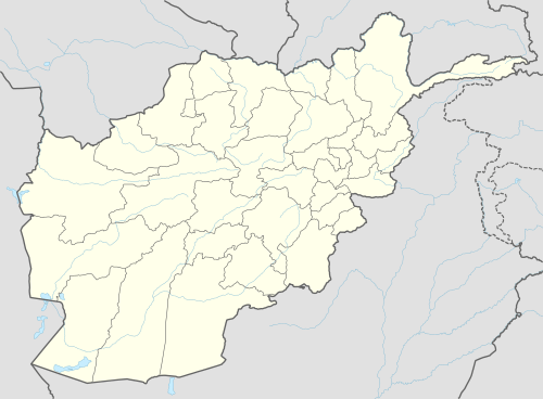 Sharana Location in Afghanistan | |
| Coordinates: 33°7′48″N 68°46′48″E / 33.13000°N 68.78000°ECoordinates: 33°7′48″N 68°46′48″E / 33.13000°N 68.78000°E | |
| Country |
|
| Province | Paktika Province |
| District | Sharana District |
| Elevation | 2,200 m (7,200 ft) |
| Population (2010) | |
| • City | 5,929 |
| • Urban | 15,651[1] |
| Time zone | UTC+4:30 |
Sharana (Pashto: ښرنه, Persian: شرنه), also Sharan or Kharana, is the capital of Paktika Province, Afghanistan. It is located at an altitude of 2,200 meters.[2] Its population was estimated to be 2,200 in 2006.[3] The city of Sharana has a population of 15,651 (in 2015). [4] It has 6 districts and a total land area of 5,893 hectares.[5] The total number of dwellings in this city are 1,739.[6]
Climate
With an influence from the local steppe climate, Sharana features a cold semi-arid climate (BSk) under the Köppen climate classification. The average temperature in Sharana is 10.8 °C, while the annual precipitation averages 265 mm. September is the driest month with 1 mm of rainfall, while March, the wettest month, has an average precipitation of 54 mm.
July is the warmest month of the year with an average temperature of 23.6 °C. The coldest month January has an average temperature of -4.5 °C, with the average lows at -10.9 °C.
| Climate data for Sharana | |||||||||||||
|---|---|---|---|---|---|---|---|---|---|---|---|---|---|
| Month | Jan | Feb | Mar | Apr | May | Jun | Jul | Aug | Sep | Oct | Nov | Dec | Year |
| Average high °C (°F) | 2.0 (35.6) |
4.8 (40.6) |
11.4 (52.5) |
17.9 (64.2) |
23.8 (74.8) |
29.6 (85.3) |
31.2 (88.2) |
30.4 (86.7) |
27.3 (81.1) |
25.5 (77.9) |
13.2 (55.8) |
6.7 (44.1) |
18.65 (65.57) |
| Daily mean °C (°F) | −4.5 (23.9) |
−1.5 (29.3) |
5.3 (41.5) |
11.0 (51.8) |
16.0 (60.8) |
21.3 (70.3) |
23.6 (74.5) |
22.6 (72.7) |
18.4 (65.1) |
11.7 (53.1) |
5.4 (41.7) |
−0.2 (31.6) |
10.76 (51.36) |
| Average low °C (°F) | −10.9 (12.4) |
−7.7 (18.1) |
−0.8 (30.6) |
4.2 (39.6) |
8.3 (46.9) |
13.1 (55.6) |
16.0 (60.8) |
14.9 (58.8) |
9.6 (49.3) |
3.0 (37.4) |
−2.4 (27.7) |
−7.0 (19.4) |
3.36 (38.05) |
| Source: Climate-Data.org[7] | |||||||||||||
Land use
Barren land and agriculture account for 73% of total land. Sharana has the largest share of land classified as institutional (14%) of any Afghan provincial capital.[8]
See also
References
- ↑ "The State of Afghan Cities report 2015".
- ↑ http://www.wolframalpha.com/entities/cities_elevation/what_is_the_elevation_of_sharan,_afghanistan%3F/lr/j8/cs/
- ↑ CityPopulation.de
- ↑ "The State of Afghan Cities report2015".
- ↑ "The State of Afghan Cities report 2015".
- ↑ "The State of Afghan Cities report2015".
- ↑ "Climate: Sharan - Climate-Data.org". Retrieved 9 September 2016.
- ↑ "The State of Afghan Cities report 2015".