Saül Airport
| Saül Airport | |||||||||||
|---|---|---|---|---|---|---|---|---|---|---|---|
|
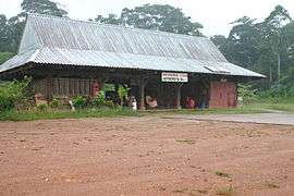
Saül Airport's terminal building | |||||||||||
| IATA: XAU – ICAO: SOOS | |||||||||||
| Summary | |||||||||||
| Operator | Conseil Général de la Guyane | ||||||||||
| Serves | Saül, French Guiana | ||||||||||
| Elevation AMSL | 735 ft / 224 m | ||||||||||
| Coordinates | 03°36′49″N 53°12′15″W / 3.61361°N 53.20417°W | ||||||||||
| Map | |||||||||||
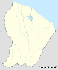 Sa Location of airport in French Guiana | |||||||||||
| Runways | |||||||||||
| |||||||||||
|
Source: French AIP[1] | |||||||||||
Saül Airport (IATA: XAU[2], ICAO: SOOS) is an airport serving Saül,[1] a commune of French Guiana.
Facilities
The airport resides at an elevation of 735 feet (224 m) above mean sea level. It has one runway designated 03/21 with an unpaved surface measuring 1,200 by 60 metres (3,937 ft × 197 ft).[1]
Airlines and destinations
| Airlines | Destinations |
|---|---|
| Air Guyane Express | Cayenne, Maripasoula[3] |
See also
 French Guiana portal
 Aviation portal
- List of airports in French Guiana
- Transport in French Guiana
References
- 1 2 3 SOOS – SAÜL. AIP from French Service d'information aéronautique, effective 8 December 2016.
- ↑ Accident history for Saul Airport (IATA: XAU, ICAO: SOOS) at Aviation Safety Network
- ↑ "Air Guyane Express". Retrieved 23 August 2010.
This article is issued from Wikipedia - version of the 11/27/2016. The text is available under the Creative Commons Attribution/Share Alike but additional terms may apply for the media files.