Sartana, Ukraine
| Sartana Сартана | ||
|---|---|---|
| Urban-type settlement | ||
|
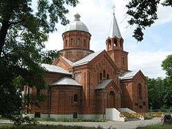
St. George's Church | ||
| ||
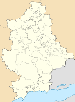 Sartana Location of Sartana in Donetsk Oblast | ||
| Coordinates: UA 47°10′00″N 37°41′00″E / 47.16667°N 37.68333°ECoordinates: UA 47°10′00″N 37°41′00″E / 47.16667°N 37.68333°E | ||
| Country |
| |
| Oblast |
| |
| Founded | 1780 | |
| Area | ||
| • Total | 6.75 km2 (2.61 sq mi) | |
| Population (2014) | ||
| • Total | 10,779 | |
| • Density | 1,600/km2 (4,100/sq mi) | |
| Time zone | MSK (UTC+2) | |
| Postal code | 87592, 87593 | |
| Area code | +380 629 | |

Sartana (Ukrainian/Russian Сартана, known as Primorskoe from 1938 to 1990) is an urban-type settlement on the banks of river Kalmius in Donetsk oblast, Ukraine. It's administratively a part of the Ilyichevsk district of the city of Mariupol. The name of the village is translated from the dialect “urum” which means "yellow calf" ( "sary" - yellow, "tana" - calf).
| Raions | |||||||
|---|---|---|---|---|---|---|---|
| Cities |
| ||||||
| |||||||
This article is issued from Wikipedia - version of the 10/28/2016. The text is available under the Creative Commons Attribution/Share Alike but additional terms may apply for the media files.