Santa Maria do Cambucá
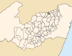
Location of Santa Maria do Cambucá within Pernambuco.
Santa Maria do Cambucá is a city in Pernambuco, Brazil.
Geography
- State - Pernambuco
- Region - Agreste Pernambucano
- Boundaries - Paraiba (N); Frei Miguelinho (S); Surubim and Vertentes do Lério (E); Vertentes (W)
- Area - 92.14 km2
- Elevation - 494 m
- Hidrography - Capibaribe river
- Vegetation - Subcaducifólia forest
- Clima - semi arid hot
- Annual average temperature - 23.0 c
- Distance to Recife - 153 km
Economy
The main economic activities in Santa Maria do Cambucá are based in general industry, and agribusiness especially plantations of beans; and creations of cattle, sheeps, goats and chickens.
Economic indicators
| Population[1] | GDP x(1000 R$).[2] | GDP pc (R$) | PE |
|---|---|---|---|
| 11.978 | 37.060 | 3.001 | 0.06% |
Economy by Sector 2006
| Primary sector | Secondary sector | Service sector |
|---|---|---|
| 8.69% | 9.17% | 82.14% |
Health indicators
| HDI (2000) | Hospitals (2007) | Hospitals beds (2007) | Children's Mortality every 1000 (2005) |
|---|---|---|---|
| 0.566 | --- | --- | 22.7 |
References
- ↑ http://www.ibge.gov.br/home/estatistica/populacao/estimativa2009/POP2009_DOU.pdf IBGE Population 2009 Santa Maria do Cambucá, page 34
- ↑ Santa Maria do Cambucá 2007 GDP IBGE pág 32
- ↑ PE State site - City by city profile
Coordinates: 7°50′24″S 35°54′07″W / 7.84°S 35.9019°W
This article is issued from Wikipedia - version of the 5/12/2016. The text is available under the Creative Commons Attribution/Share Alike but additional terms may apply for the media files.