Sainte-Foy-la-Longue
| Sainte-Foy-la-Longue | |
|---|---|
|
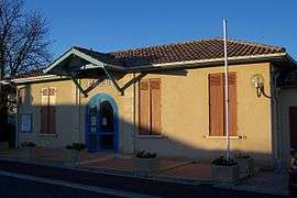
Town hall | |
 Sainte-Foy-la-Longue | |
|
Location within Nouvelle-Aquitaine region  Sainte-Foy-la-Longue | |
| Coordinates: 44°36′39″N 0°08′40″W / 44.6108°N 0.1444°WCoordinates: 44°36′39″N 0°08′40″W / 44.6108°N 0.1444°W | |
| Country | France |
| Region | Nouvelle-Aquitaine |
| Department | Gironde |
| Arrondissement | Langon |
| Canton | Saint-Macaire |
| Intercommunality | Coteaux Macariens |
| Government | |
| • Mayor (2008–2014) | Jean Michel Bentejac |
| Area1 | 9.37 km2 (3.62 sq mi) |
| Population (2008)2 | 134 |
| • Density | 14/km2 (37/sq mi) |
| Time zone | CET (UTC+1) |
| • Summer (DST) | CEST (UTC+2) |
| INSEE/Postal code | 33403 / 33490 |
| Elevation |
40–113 m (131–371 ft) (avg. 109 m or 358 ft) |
|
1 French Land Register data, which excludes lakes, ponds, glaciers > 1 km² (0.386 sq mi or 247 acres) and river estuaries. 2 Population without double counting: residents of multiple communes (e.g., students and military personnel) only counted once. | |
Sainte-Foy-la-Longue is a commune in the Gironde department in Nouvelle-Aquitaine in southwestern France.
Population
| Historical population | ||
|---|---|---|
| Year | Pop. | ±% |
| 1962 | 133 | — |
| 1968 | 148 | +11.3% |
| 1975 | 139 | −6.1% |
| 1982 | 134 | −3.6% |
| 1990 | 151 | +12.7% |
| 1999 | 115 | −23.8% |
| 2008 | 134 | +16.5% |
See also
References
| Wikimedia Commons has media related to Sainte-Foy-la-Longue. |
This article is issued from Wikipedia - version of the 11/9/2016. The text is available under the Creative Commons Attribution/Share Alike but additional terms may apply for the media files.