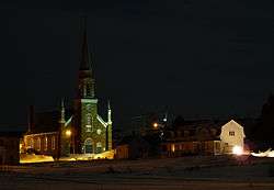
Saint-Simon, Bas-Saint-Laurent, Quebec
| Saint-Simon | |
|---|---|
| Parish municipality | |
 | |
_Quebec_location_diagram.png) Location within Les Basques RCM | |
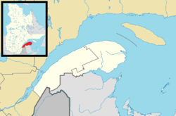 Saint-Simon Location in eastern Quebec | |
| Coordinates: 48°12′N 69°03′W / 48.2°N 69.05°WCoordinates: 48°12′N 69°03′W / 48.2°N 69.05°W[1] | |
| Country |
|
| Province |
|
| Region | Bas-Saint-Laurent |
| RCM | Les Basques |
| Constituted | July 1, 1855 |
| Government[2] | |
| • Mayor | Jérôme Rouleau |
| • Federal riding |
Rimouski-Neigette—Témiscouata —Les Basques |
| • Prov. riding | Rivière-du-Loup-Témiscouata |
| Area[2][3] | |
| • Total | 74.30 km2 (28.69 sq mi) |
| • Land | 75.07 km2 (28.98 sq mi) |
| There is an apparent contradiction between two authoritative sources | |
| Population (2011)[3] | |
| • Total | 438 |
| • Density | 5.8/km2 (15/sq mi) |
| • Pop 2006-2011 |
|
| • Dwellings | 332 |
| Postal code(s) | G0L 4C0 |
| Area code(s) | 418 and 581 |
| Highways |
|
| Website |
www |
Saint-Simon is a parish municipality in the Les Basques Regional County Municipality in the Bas-Saint-Laurent region of Quebec, Canada. Its population in the Canada 2011 Census was 438.[2][3]
Demographics
Population
| Canada census – Saint-Simon, Bas-Saint-Laurent, Quebec community profile | |||
|---|---|---|---|
| 2011 | 2006 | 2001 | |
| Population: | 438 (+0.2% from 2006) | 437 (-3.1% from 2001) | 451 (-10.5% from 1996) |
| Land area: | 75.07 km2 (28.98 sq mi) | 75.07 km2 (28.98 sq mi) | 75.09 km2 (28.99 sq mi) |
| Population density: | 5.8/km2 (15/sq mi) | 5.8/km2 (15/sq mi) | 6.0/km2 (16/sq mi) |
| Median age: | 54.1 (M: 53.9, F: 54.3) | 48.8 (M: 47.3, F: 50.2) | 44.0 (M: 43.2, F: 44.9) |
| Total private dwellings: | 332 | 316 | 320 |
| Median household income: | $41,466 | $32,732 | $27,724 |
| References: 2011[4] 2006[5] 2001[6] | |||
| Historical Census Data - Saint-Simon, Bas-Saint-Laurent, Quebec[7] | ||
|---|---|---|
| Year | Pop. | ±% |
| 1991 | 491 | — |
| 1996 | 504 | +2.6% |
| 2001 | 451 | −10.5% |
| 2006 | 437 | −3.1% |
| 2011 | 438 | +0.2% |
Language
| Canada Census Mother Tongue - Saint-Simon, Bas-Saint-Laurent, Quebec[7] | ||||||||||||||||||
|---|---|---|---|---|---|---|---|---|---|---|---|---|---|---|---|---|---|---|
| Census | Total | French |
English |
French & English |
Other | |||||||||||||
| Year | Responses | Count | Trend | Pop % | Count | Trend | Pop % | Count | Trend | Pop % | Count | Trend | Pop % | |||||
| 2011 |
440 |
435 | |
98.86% | 5 | |
1.14% | 0 | |
0.00% | 0 | |
0.00% | |||||
| 2006 |
435 |
415 | |
95.40% | 0 | |
0.00% | 0 | |
0.00% | 20 | |
4.60% | |||||
| 2001 |
0 |
445 | |
100.00% | 0 | |
0.00% | 0 | |
0.00% | 0 | |
0.00% | |||||
| 1996 |
505 |
505 | n/a | 100.00% | 0 | n/a | 0.00% | 0 | n/a | 0.00% | 0 | n/a | 0.00% | |||||
See also
References
- ↑ Reference number 57653 of the Commission de toponymie du Québec (French)
- 1 2 3 Geographic code 11055 in the official Répertoire des municipalités (French)
- 1 2 3 "(Code 2411055) Census Profile". 2011 census. Statistics Canada. 2012.
- ↑ "2011 Community Profiles". Canada 2011 Census. Statistics Canada. July 5, 2013. Retrieved 2014-03-14.
- ↑ "2006 Community Profiles". Canada 2006 Census. Statistics Canada. March 30, 2011. Retrieved 2014-03-14.
- ↑ "2001 Community Profiles". Canada 2001 Census. Statistics Canada. February 17, 2012. Retrieved 2014-03-14.
- 1 2 Statistics Canada: 1996, 2001, 2006, 2011 census
External links
![]() Media related to Saint-Simon, Bas-Saint-Laurent, Quebec at Wikimedia Commons
Media related to Saint-Simon, Bas-Saint-Laurent, Quebec at Wikimedia Commons
 |
Les Escoumins Saint Lawrence River |
Longue-Rive Saint Lawrence River |
Saint-Fabien | |
| |
||||
| ||||
| | ||||
| Notre-Dame-des-Neiges | |
Saint-Mathieu-de-Rioux |
| Cities & Towns | |
|---|---|
| Municipalities | |
| Parishes | |
| Unorganized territories | |
| |
This article is issued from Wikipedia - version of the 12/1/2016. The text is available under the Creative Commons Attribution/Share Alike but additional terms may apply for the media files.