Saint-Siméon, Gaspésie–Îles-de-la-Madeleine, Quebec
For the town in Capitale-Nationale, see Saint-Siméon, Capitale-Nationale, Quebec.
| Saint-Siméon | |
|---|---|
| Parish municipality | |
_Quebec_location_diagram.png) Location within Bonaventure RCM. | |
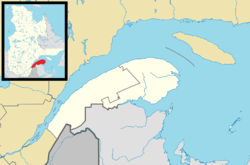 Saint-Siméon Location in eastern Quebec. | |
| Coordinates: 48°04′N 65°34′W / 48.067°N 65.567°WCoordinates: 48°04′N 65°34′W / 48.067°N 65.567°W[1] | |
| Country |
|
| Province |
|
| Region |
Gaspésie– Îles-de-la-Madeleine |
| RCM | Bonaventure |
| Settled | 1760 |
| Constituted | October 29, 1914 |
| Government[2] | |
| • Mayor | Jean Guy Poirier |
| • Federal riding |
Gaspésie— Îles-de-la-Madeleine |
| • Prov. riding | Bonaventure |
| Area[2][3] | |
| • Total | 56.30 km2 (21.74 sq mi) |
| • Land | 56.37 km2 (21.76 sq mi) |
|
There is an apparent contradiction between two authoritative sources | |
| Population (2011)[3] | |
| • Total | 1,179 |
| • Density | 20.9/km2 (54/sq mi) |
| • Pop 2006-2011 |
|
| • Dwellings | 567 |
| Time zone | EST (UTC−5) |
| • Summer (DST) | EDT (UTC−4) |
| Postal code(s) | G0C 3A0 |
| Area code(s) | 418 and 581 |
| Highways |
|
Saint-Siméon is a parish municipality in Quebec, Canada. It is also sometimes called Saint-Siméon-de-Bonaventure to avoid confusion with Saint-Siméon in the Capitale-Nationale region.[1]
Demographics
| Canada census – Saint-Siméon, Gaspésie–Îles-de-la-Madeleine, Quebec community profile | |||
|---|---|---|---|
| 2011 | 2006 | 2001 | |
| Population: | 1,179 (+0.4% from 2006) | 1,174 (-3.1% from 2001) | 1,211 (0.0% from 1996) |
| Land area: | 56.37 km2 (21.76 sq mi) | 56.37 km2 (21.76 sq mi) | 56.37 km2 (21.76 sq mi) |
| Population density: | 20.9/km2 (54/sq mi) | 20.8/km2 (54/sq mi) | 21.5/km2 (56/sq mi) |
| Median age: | 49.0 (M: 48.6, F: 49.3) | 45.4 (M: 44.8, F: 46.0) | 42.9 (M: 42.3, F: 43.7) |
| Total private dwellings: | 567 | 523 | 510 |
| Median household income: | $.N/A | $44,310 | $42,773 |
| Notes: 2011 income data for this area has been suppressed for data quality or confidentiality reasons. – References: 2011[3] 2006[4] 2001[5] | |||
| Historical Census Data - Saint-Siméon, Gaspésie–Îles-de-la-Madeleine, Quebec[6] | ||||||||||||||||||||||||||
|---|---|---|---|---|---|---|---|---|---|---|---|---|---|---|---|---|---|---|---|---|---|---|---|---|---|---|
|
|
| ||||||||||||||||||||||||
See also
References
- 1 2 "Saint-Siméon (Municipalité de paroisse)" (in French). Commission de toponymie du Québec. Retrieved 2011-12-29.
- 1 2 "Saint-Siméon". Répertoire des municipalités (in French). Ministère des Affaires municipales, des Régions et de l'Occupation du territoire. Retrieved 2011-12-29.
- 1 2 3 "Saint-Siméon census profile". 2011 Census data. Statistics Canada. Retrieved 2011-12-29.
- ↑ "2006 Community Profiles". Canada 2006 Census. Statistics Canada. March 30, 2011. Retrieved 2011-12-29.
- ↑ "2001 Community Profiles". Canada 2001 Census. Statistics Canada. February 17, 2012. Retrieved 2011-12-29.
- ↑ Statistics Canada: 1996, 2001, 2006, 2011 census
 |
Saint-Alphonse | Saint-Elzéar | | |
| Caplan | |
Bonaventure | ||
| ||||
| | ||||
| Chaleur Bay |
| Cities | |
|---|---|
| Municipalities | |
| Parishes | |
| Townships | |
| Unorganized Territories | |
| |
This article is issued from Wikipedia - version of the 3/8/2014. The text is available under the Creative Commons Attribution/Share Alike but additional terms may apply for the media files.