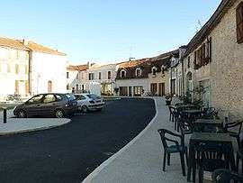
Saint-Séverin
| Saint-Séverin | |
|---|---|
 | |
 Saint-Séverin | |
|
Location within Nouvelle-Aquitaine region  Saint-Séverin | |
| Coordinates: 45°18′50″N 0°15′16″E / 45.3139°N 0.2544°ECoordinates: 45°18′50″N 0°15′16″E / 45.3139°N 0.2544°E | |
| Country | France |
| Region | Nouvelle-Aquitaine |
| Department | Charente |
| Arrondissement | Angoulême |
| Canton | Aubeterre-sur-Dronne |
| Government | |
| • Mayor (2008–2014) | Alain Rivière |
| Area1 | 14.93 km2 (5.76 sq mi) |
| Population (2008)2 | 787 |
| • Density | 53/km2 (140/sq mi) |
| Time zone | CET (UTC+1) |
| • Summer (DST) | CEST (UTC+2) |
| INSEE/Postal code | 16350 / 16390 |
| Elevation |
45–134 m (148–440 ft) (avg. 108 m or 354 ft) |
|
1 French Land Register data, which excludes lakes, ponds, glaciers > 1 km² (0.386 sq mi or 247 acres) and river estuaries. 2 Population without double counting: residents of multiple communes (e.g., students and military personnel) only counted once. | |
Saint-Séverin is a commune in the Charente department in southwestern France.
Geography
The Lizonne forms the commune's eastern border, then flows into the Dronne, which forms the commune's southern border.
Population
| Historical population | ||
|---|---|---|
| Year | Pop. | ±% |
| 1793 | 1,144 | — |
| 1800 | 1,256 | +9.8% |
| 1806 | 1,299 | +3.4% |
| 1821 | 1,240 | −4.5% |
| 1831 | 1,293 | +4.3% |
| 1841 | 1,302 | +0.7% |
| 1846 | 1,332 | +2.3% |
| 1851 | 1,379 | +3.5% |
| 1856 | 1,396 | +1.2% |
| 1861 | 1,363 | −2.4% |
| 1866 | 1,496 | +9.8% |
| 1872 | 1,278 | −14.6% |
| 1876 | 1,290 | +0.9% |
| 1881 | 1,405 | +8.9% |
| 1886 | 1,258 | −10.5% |
| 1891 | 1,273 | +1.2% |
| 1896 | 1,182 | −7.1% |
| 1901 | 1,114 | −5.8% |
| 1906 | 1,123 | +0.8% |
| 1911 | 1,147 | +2.1% |
| 1921 | 970 | −15.4% |
| 1926 | 968 | −0.2% |
| 1931 | 907 | −6.3% |
| 1936 | 911 | +0.4% |
| 1946 | 872 | −4.3% |
| 1954 | 861 | −1.3% |
| 1962 | 842 | −2.2% |
| 1968 | 824 | −2.1% |
| 1975 | 721 | −12.5% |
| 1982 | 741 | +2.8% |
| 1990 | 777 | +4.9% |
| 1999 | 728 | −6.3% |
| 2008 | 787 | +8.1% |
See also
References
| Wikimedia Commons has media related to Saint-Séverin (Charente). |
This article is issued from Wikipedia - version of the 2/11/2016. The text is available under the Creative Commons Attribution/Share Alike but additional terms may apply for the media files.