Rajakumari
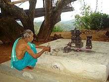
Tribal temple at Rajakumari
| Rajakumari രാജകുമാരി | |
|---|---|
| village | |
| Coordinates: 9°58′10″N 77°08′54″E / 9.969474°N 77.148333°ECoordinates: 9°58′10″N 77°08′54″E / 9.969474°N 77.148333°E | |
| Country |
|
| State | Kerala |
| District | Idukki |
| Population (2001) | |
| • Total | 15,243 |
| Languages | |
| • Official | Malayalam, English |
| Time zone | IST (UTC+5:30) |
| PIN | 685619 |
| Telephone code | 04868 |
| Vehicle registration | KL 37 KL 69 |
| Nearest city | Nedumkandam |
| Lok Sabha constituency | Idukki |
| Vidhan Sabha constituency | Udumbanchola |
| Climate | Moderate Cold, fine climate (Köppen) |
Rajakumari is a village in Idukki district in the Indian state of Kerala.[1]
Demographics
As of 2011 India census, Rajakumari had a population of 15243 with 7675 males and 7568 females.[1] Rajakumari is one of the few places in Kerala where all kinds of crops are grown. Peoples main occupation here is cardamom and pepper.
Education Institutions
References
- 1 2 "Census of India : Villages with population 5000 & above". Retrieved 2008-12-10.
|first1=missing|last1=in Authors list (help)
This article is issued from Wikipedia - version of the 11/23/2016. The text is available under the Creative Commons Attribution/Share Alike but additional terms may apply for the media files.