Quebec Route 233
| ||||
|---|---|---|---|---|
 | ||||
| Route information | ||||
| Maintained by Transports Québec | ||||
| Length: | 34.2 km[1] (21.3 mi) | |||
| Major junctions | ||||
| South end: |
| |||
|
| ||||
| North end: |
| |||
| Highway system | ||||
| ||||

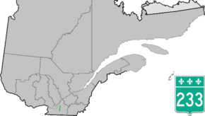
Route 233 is a provincial highway located in the Montérégie region of Quebec east of Montreal. The highway links Farnham and Saint-Césaire with Saint-Hyacinther. It starts at a junction with Route 104 between Farnham and Sainte-Brigide-d'Iberville, next to a training facility of the Canadian Forces and runs north toward a parclo interchange with Autoroute 10 after which it crosses the Rivière du Sud-Ouest which it follows for a few kilometers until its headwaters on Yamaska River. Shortly after it runs through Saint-Césaire, crossing Route 112, before continuing to follow the Yamaska until its end at the junction of Route 231.
Municipalities along Route 233
See also
References
- ↑ Ministère des transports, "Distances routières", page 86, Les Publications du Québec, 2005
External links
- Official Transports Quebec Provincial Road Network Map (French)
- 233 on GoogleMaps
This article is issued from Wikipedia - version of the 11/9/2016. The text is available under the Creative Commons Attribution/Share Alike but additional terms may apply for the media files.