Port of Latakia
| Port of Latakia ميناء اللاذقية | |
|---|---|
|
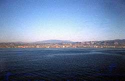
Port of Latakia in 1979 | |
| Location | |
| Country | Syria |
| Location |
Latakia Latakia Governorate |
| Coordinates | 35°30′48″N 35°46′14″E / 35.51333°N 35.77056°ECoordinates: 35°30′48″N 35°46′14″E / 35.51333°N 35.77056°E |
| Details | |
| Opened |
Ancient harbor: 2000 BC Modern harbor: 1951 |
| Operated by | Public Company of the Port of Latakia |
| Owned by | State-owned |
| Type of harbor | Natural |
| Size of harbor | 135 hectares (0.52 sq mi) |
| Land area | 15 hectares (0.058 sq mi) |
| Size | 150 hectares (0.58 sq mi) |
| Wharfs | 32 |
| General Manager | Suleiman Asaad Baloush |
| Cranes | 18 |
| Channel depth | 14.5 metres (48 ft) |
| Warehouse space | 62.8 hectares (0.242 sq mi) |
| Statistics | |
| Vessel arrivals | 1805 |
| Annual cargo tonnage | 8,093,000 |
|
Website http://www.lattakiaport.gov.sy/ | |
The Port of Latakia (Arabic: ميناء اللاذقية) is the main seaport in Syria. It is located on the Mediterranean Sea in the city of Latakia.
General statistics
In 2008, the port handled about 8 million tonnes of cargo.
| Year | 2002 | 2003 | 2004 | 2005 | 2006 | 2007 | 2008 |
|---|---|---|---|---|---|---|---|
| Imports * | 3.644 | 3.871 | 5.083 | 6.239 | 6.931 | 6.349 | 6.800 |
| Exports * | 0.905 | 0.996 | 1.019 | 1.083 | 1.162 | 1.471 | 1.262 |
- * figures in millions of tonnes
References
Bibliography
- Ring, Trudy; Salkin, Robert M.; La Boda, Sharon (1994), International Dictionary of Historic Places, Taylor & Francis, ISBN 978-1-884964-03-9.
- Ball, Warwick (2000), Rome in the East: The Transformation of an Empire, Routledge, ISBN 978-0-415-11376-2.
- Maʻoz, Moshe; Yaniv, Avner; Gustav Heinemann Institute of Middle Eastern Studies (1986), Syria Under Assad: Domestic Constraints and Regional Risks, Taylor & Francis, ISBN 0-7099-2910-2.
This article is issued from Wikipedia - version of the 9/24/2016. The text is available under the Creative Commons Attribution/Share Alike but additional terms may apply for the media files.