Platanissos
| Platanissos | |
|---|---|
| Πλατανισσός (Greek) Balalan (Turkish) | |
 Platanissos Location in Cyprus | |
| Coordinates: 35°28′41″N 34°6′23″E / 35.47806°N 34.10639°ECoordinates: 35°28′41″N 34°6′23″E / 35.47806°N 34.10639°E | |
| Country |
|
| • District | Famagusta District |
| Country (controlled by) |
|
| • District | İskele District |
| Government | |
| • Mukhtar | Cafer Özbalalanlı |
| Population (2011)[1] | |
| • Total | 89 |
| Time zone | EET (UTC+2) |
| • Summer (DST) | EEST (UTC+3) |
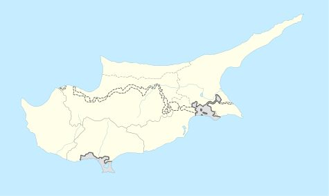
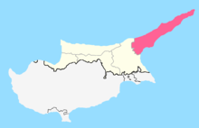
Platanissos (Greek: Πλατανισσός, Turkish: Balalan) is a village in the Famagusta District of Cyprus, located on the Karpas Peninsula. It is under the de facto control of Northern Cyprus.
References
- ↑ KKTC 2011 Nüfus ve Konut Sayımı [Northern Cyprus 2011 Population and Housing Census] (PDF), Northern Cyprus State Planning Organization, 6 August 2013

This article is issued from Wikipedia - version of the 4/15/2016. The text is available under the Creative Commons Attribution/Share Alike but additional terms may apply for the media files.