Piz Mitgel
| Piz Mitgel | |
|---|---|
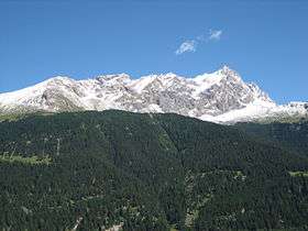 View from Riom-Parsonz (western side) | |
| Highest point | |
| Elevation | 3,159 m (10,364 ft) [1] |
| Prominence | 447 m (1,467 ft) [2] |
| Parent peak | Corn da Tinizong |
| Coordinates | 46°36′51.3″N 9°38′47.7″E / 46.614250°N 9.646583°ECoordinates: 46°36′51.3″N 9°38′47.7″E / 46.614250°N 9.646583°E |
| Geography | |
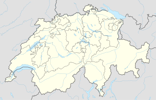 Piz Mitgel Location in Switzerland | |
| Location | Graubünden, Switzerland |
| Parent range | Albula Range |
Piz Mitgel is a mountain in the Albula Range of the Alps, overlooking Savognin, in the canton of Graubünden. Similarly to its higher neighbor, Corn da Tinizong, it has an almost vertical south face. A via ferrata (Senda Ferrada) leads to the summit.
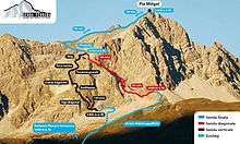
Routes to the summit
References
- ↑ Swisstopo map
- ↑ Google Earth
External links
 Media related to Piz Mitgel at Wikimedia Commons
- Piz Mitgel on Hikr
- Piz Mitgel on Summitpost
This article is issued from Wikipedia - version of the 5/9/2016. The text is available under the Creative Commons Attribution/Share Alike but additional terms may apply for the media files.