Osztopán
| Osztopán | |
|---|---|
 Osztopán Location of Osztopán | |
| Coordinates: 46°31′13″N 17°40′14″E / 46.52032°N 17.67068°ECoordinates: 46°31′13″N 17°40′14″E / 46.52032°N 17.67068°E | |
| Country |
|
| County | Somogy |
| Area | |
| • Total | 22.83 km2 (8.81 sq mi) |
| Population (2004) | |
| • Total | 844 |
| • Density | 36.96/km2 (95.7/sq mi) |
| Time zone | CET (UTC+1) |
| • Summer (DST) | CEST (UTC+2) |
| Postal code | 7444 |
| Area code(s) | 82 |
Osztopán is a village in Somogy county, Hungary.
External links
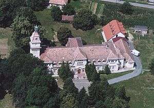
Osztopn, palace from above
This article is issued from Wikipedia - version of the 2/6/2014. The text is available under the Creative Commons Attribution/Share Alike but additional terms may apply for the media files.