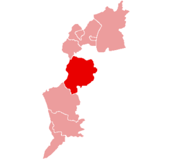
Oberpullendorf District
| Bezirk Oberpullendorf | |
|---|---|
| District | |
 | |
| Country | Austria |
| State | Burgenland |
| Number of municipalities | 27 |
| Area | |
| • Total | 648.39 km2 (250.34 sq mi) |
| Population (2012) | |
| • Total | 37,587 |
| • Density | 58/km2 (150/sq mi) |
| Time zone | CET (UTC+1) |
| • Summer (DST) | CEST (UTC+2) |
| NUTS code | ? |
Bezirk Oberpullendorf (Croatian: Kotar Gornja Pulja) is a district of the state of Burgenland in Austria.
Municipalities
Towns (Städte) are indicated in boldface; market towns (Marktgemeinden) in italics; suburbs, hamlets and other subdivisions of a municipality are indicated in small characters. Where appropriate, the Hungarian or Croatian names are given in parentheses.
- Deutschkreutz (3,126)
- Girm
- Draßmarkt (1,376)
- Karl, Oberrabnitz
- Frankenau-Unterpullendorf (Frakanava-Dolnja Pulja) (1,179)
- Frankenau, Großmutschen, Kleinmutschen, Unterpullendorf
- Großwarasdorf (Veliki Borištof) (1,452)
- Kleinwarasdorf, Langental, Nebersdorf
- Horitschon (1,881)
- Unterpetersdorf
- Kaisersdorf (Kalištrof) (610)
- Kobersdorf (1,928)
- Lindgraben, Oberpetersdorf
- Lackenbach (1,112)
- Lackendorf (570)
- Lockenhaus (2,011)
- Glashütten bei Langeck im Burgenland, Hammerteich, Hochstraß, Langeck im Burgenland
- Lutzmannsburg (885)
- Strebersdorf
- Mannersdorf an der Rabnitz (1,804)
- Klostermarienberg, Liebing, Rattersdorf, Unterloisdorf
- Markt Sankt Martin (1,175)
- Landsee, Neudorf bei Landsee
- Neckenmarkt (1,695)
- Haschendorf
- Neutal (1,055)
- Nikitsch (Filež) (1,424)
- Kroatisch Geresdorf (Gerištof), Kroatisch Minihof (Mjenovo)
- Oberloisdorf (780)
- Oberpullendorf (Hungarian: Felsőpulya) (3,029)
- Mitterpullendorf
- Pilgersdorf (1,661)
- Bubendorf im Burgenland, Deutsch Gerisdorf, Kogl im Burgenland, Lebenbrunn, Salmannsdorf im Burgenland, Steinbach im Burgenland
- Piringsdorf (863)
- Raiding (815)
- Ritzing (916)
- Steinberg-Dörfl (1,259)
- Dörfl, Steinberg
- Stoob (1,466)
- Unterfrauenhaid (665)
- Unterrabnitz-Schwendgraben (650)
- Schwendgraben, Unterrabnitz
- Weingraben (Bajngrob) (362)
- Weppersdorf (1,838)
- Kalkgruben, Tschurndorf
| Cities |  | |
|---|---|---|
| Districts | ||
Coordinates: 47°32′02″N 16°29′46″E / 47.534°N 16.496°E
This article is issued from Wikipedia - version of the 6/22/2015. The text is available under the Creative Commons Attribution/Share Alike but additional terms may apply for the media files.