Norris Arm
Not to be confused with Norris Point, Newfoundland and Labrador.
| Norris Arm | ||
|---|---|---|
| Town | ||
| ||
| Motto: "The Town With The Sensational Sunset" | ||
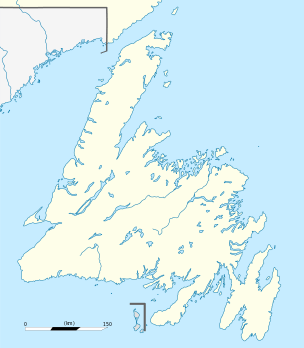 Norris Arm Location of Norris Arm in Newfoundland | ||
| Coordinates: 49°05′N 55°16′W / 49.083°N 55.267°WCoordinates: 49°05′N 55°16′W / 49.083°N 55.267°W | ||
| Country |
| |
| Province |
| |
| Census division | 6 | |
| Settled | 1700's | |
| Incorporated (town) | 1971 | |
| Government | ||
| • Type | Norris Arm Town Council | |
| • Mayor | Fred Budgell | |
| • MP | Scott Simms (Liberal) | |
| • MHA | Wade Verge (PC) | |
| Area | ||
| • Total | 41.49 km2 (16.02 sq mi) | |
| Elevation | 22 m (72 ft) | |
| Population (2011)[1] | ||
| • Total | 912 | |
| • Density | 22/km2 (57/sq mi) | |
| Time zone | Newfoundland Time (UTC-3:30) | |
| • Summer (DST) | Newfoundland Daylight (UTC-2:30) | |
| Postal Code Span | A0G | |
| Area code(s) | 709 | |
| Highways | Route 1 | |
| Website | Norris Arm official site | |
Norris Arm is a town in north-central Newfoundland, Newfoundland and Labrador, Canada. It is in Division No. 6, on the Bay of Exploits.
Demographics
According to the 2011[1] Statistics Canada Census:
- Population: 912
- % Change (2006–2011): approx. 0.1%
- Dwellings: 545
- Area (km²): 41.49
- Density (persons per km²): 22.0
Climate
| Climate data for Norris Arm | |||||||||||||
|---|---|---|---|---|---|---|---|---|---|---|---|---|---|
| Month | Jan | Feb | Mar | Apr | May | Jun | Jul | Aug | Sep | Oct | Nov | Dec | Year |
| Record high °C (°F) | 13.5 (56.3) |
14 (57) |
17 (63) |
23.5 (74.3) |
29 (84) |
33 (91) |
34 (93) |
35 (95) |
30 (86) |
25.6 (78.1) |
21.1 (70) |
17.8 (64) |
35 (95) |
| Average high °C (°F) | −2 (28) |
−2.2 (28) |
1.7 (35.1) |
6.4 (43.5) |
13 (55) |
18.8 (65.8) |
23.4 (74.1) |
22.1 (71.8) |
17.1 (62.8) |
11 (52) |
5.9 (42.6) |
0.5 (32.9) |
9.7 (49.5) |
| Daily mean °C (°F) | −6.8 (19.8) |
−7.4 (18.7) |
−3 (27) |
2.2 (36) |
7.8 (46) |
13 (55) |
17.7 (63.9) |
16.7 (62.1) |
12 (54) |
6.7 (44.1) |
2.2 (36) |
−3.6 (25.5) |
4.8 (40.6) |
| Average low °C (°F) | −11.8 (10.8) |
−12.8 (9) |
−7.8 (18) |
−2 (28) |
2.5 (36.5) |
7.1 (44.8) |
11.9 (53.4) |
11.3 (52.3) |
6.9 (44.4) |
2.4 (36.3) |
−1.6 (29.1) |
−7.9 (17.8) |
−0.2 (31.6) |
| Record low °C (°F) | −32.8 (−27) |
−36.7 (−34.1) |
−32 (−26) |
−18.5 (−1.3) |
−9.4 (15.1) |
−3.5 (25.7) |
0 (32) |
−0.6 (30.9) |
−3.3 (26.1) |
−10 (14) |
−20 (−4) |
−33.3 (−27.9) |
−36.7 (−34.1) |
| Average precipitation mm (inches) | 108 (4.25) |
92.3 (3.634) |
105.6 (4.157) |
82.4 (3.244) |
81.7 (3.217) |
85.3 (3.358) |
80.4 (3.165) |
103.1 (4.059) |
82.7 (3.256) |
104.4 (4.11) |
100.5 (3.957) |
107.8 (4.244) |
1,134.2 (44.654) |
| Source: 1961-1990 Environment Canada[2] | |||||||||||||
See also
References
- 1 2 "Norris Arm Census Profile". Statistics Canada. Retrieved 16 October 2012.
- ↑ Environment Canada—1961–1990. Retrieved 15 October 2012.
External links
 |
Division No. 6, Subd. D | | ||
| Bay of Exploits | |
Division No. 6, Subd. D | ||
| ||||
| | ||||
| Division No. 6, Subd. D |
This article is issued from Wikipedia - version of the 11/13/2016. The text is available under the Creative Commons Attribution/Share Alike but additional terms may apply for the media files.