Mount Tanzawa
| Mount Tanzawa | |
|---|---|
| 丹沢山 | |
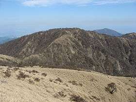 View from Mount Fudō | |
| Highest point | |
| Elevation | 1,567.1 m (5,141 ft) |
| Prominence | 117 m (384 ft) |
| Parent peak | Mount Hiru |
| Listing | List of mountains and hills of Japan by height |
| Coordinates | 35°28′27″N 139°9′46″E / 35.47417°N 139.16278°ECoordinates: 35°28′27″N 139°9′46″E / 35.47417°N 139.16278°E |
| Geography | |
| Location | Kanagawa Prefecture, Japan |
| Parent range | Tanzawa Mountains |
| Topo map |
Geographical Survey Institute 25000:1 大山 50000:1 東京山 |
Mount Tanzawa (丹沢山 Tanzawa-san, -yama) is a mountain of the Tanzawa Mountains, with an elevation of 1,567.1 metres (5,141 ft). Its summit marks the border between Sagamihara, Kiyokawa in Aikō District, and Yamakita in Ashigarakami District.
Gallery
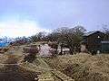 The top of Mount Tanzawa
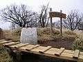 The top of Mount Tanzawa
 Mount Fuji from Mount Tanzawa
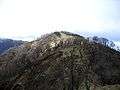 Mount Tanzawa from south
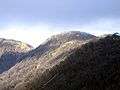 Mount Tanzawa from Mount Tō
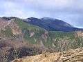 Mount Tanzawa from Mount Sannotō
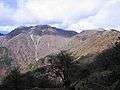 Mount Hiru, Mount Fudō and Mount Tanzawa from Mount Tō
References
| Wikimedia Commons has media related to Mount Tanzawa. |
This article is issued from Wikipedia - version of the 5/26/2015. The text is available under the Creative Commons Attribution/Share Alike but additional terms may apply for the media files.