Mount Gabb
| Mount Gabb | |
|---|---|
 Mount Gabb  Mount Gabb | |
| Highest point | |
| Elevation | 13,747 ft (4,190 m) [1] |
| Prominence | 2,581 ft (787 m) [1] |
| Coordinates | 37°22′36″N 118°48′09″W / 37.37667°N 118.80250°WCoordinates: 37°22′36″N 118°48′09″W / 37.37667°N 118.80250°W [2] |
| Geography | |
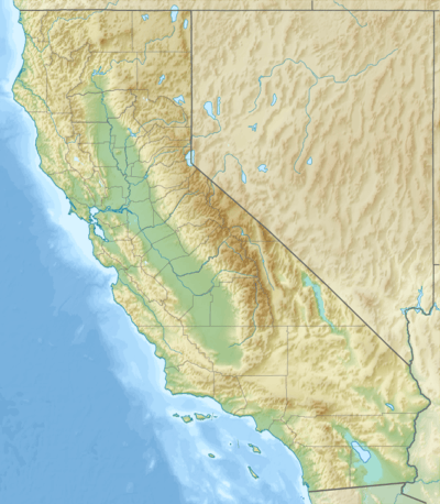
| Location | Fresno County, California, U.S. |
| Parent range | Sierra Nevada |
| Topo map | USGS Mount Abbot |
Mount Gabb (13,747 feet (4,190 m)) is in the central Sierra Nevada in the U.S. state of California.[3] Mount Gabb is in the John Muir Wilderness of Sierra National Forest.
References
- 1 2 "Mount Gabb, California". Peakbagger.com. Retrieved April 13, 2016.
- ↑ "Mount Gabb". Geographic Names Information System. United States Geological Survey. Retrieved April 13, 2016.
- ↑ Mount Abbot, CA (Map). TopoQwest (United States Geological Survey Maps). Retrieved April 13, 2016.
This article is issued from Wikipedia - version of the 10/17/2016. The text is available under the Creative Commons Attribution/Share Alike but additional terms may apply for the media files.