Moris Municipality
| Moris | |
|---|---|
| Municipality | |
 Municipality of Moris in Chihuahua | |
|
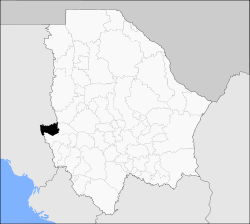
Moris Location in Mexico | |
| Coordinates: 28°8′55″N 108°31′21″W / 28.14861°N 108.52250°WCoordinates: 28°8′55″N 108°31′21″W / 28.14861°N 108.52250°W | |
| Country |
|
| State | Chihuahua |
| Municipal seat | Moris |
| Area | |
| • Total | 2,219.7 km2 (857.0 sq mi) |
| Population (2010) | |
| • Total | 5,312 |
| • Density | 2.4/km2 (6.2/sq mi) |
Moris is one of the 67 municipalities of Chihuahua, in north-western Mexico. The municipal seat lies at Moris. The municipality covers an area of 2,219.7 km².
As of 2010, the municipality had a total population of 5,312,[1] up from 5,144 as of 2005.[2]
As of 2010, the town of Moris had a population of 1,799.[1] Other than the town of Moris, the municipality had 183 localities, none of which had a population over 1,000.[1]
Geography
Towns and villages
The municipality has 119 localities. The largest are:
| Name | Population (2005) |
|---|---|
| Moris | 1,158 |
| El Pilar | 379 |
| La Cieneguita de Rodríguez | 236 |
| Talayotes | 215 |
| Ciénega del Pilar | 211 |
| Sierra Obscura | 156 |
| Total Municipality | 5,144 |
References
- 1 2 3 "Moris". Catálogo de Localidades. Secretaría de Desarrollo Social (SEDESOL). Retrieved 23 April 2014.
- ↑ "Morelos". Enciclopedia de los Municipios de México. Instituto Nacional para el Federalismo y el Desarrollo Municipal. Retrieved October 19, 2008.

This article is issued from Wikipedia - version of the 7/31/2016. The text is available under the Creative Commons Attribution/Share Alike but additional terms may apply for the media files.