Minamiaiki, Nagano
| Minamiaiki 南相木村 | |
|---|---|
| Village | |
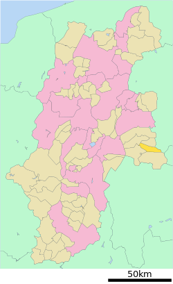 Location of Minamiaiki in Nagano Prefecture | |
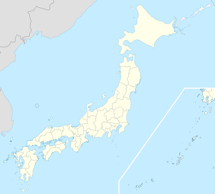 Minamiaiki Location in Japan | |
| Coordinates: 36°2′N 138°33′E / 36.033°N 138.550°ECoordinates: 36°2′N 138°33′E / 36.033°N 138.550°E | |
| Country | Japan |
| Region |
Chūbu Kōshin'etsu |
| Prefecture | Nagano Prefecture |
| District | Minamisaku |
| Area | |
| • Total | 66.03 km2 (25.49 sq mi) |
| Population (October 1, 2007) | |
| • Total | 1,106 |
| • Density | 17/km2 (43/sq mi) |
| Symbols | |
| • Tree | Japanese red pine |
| • Flower | Prunus serrulata |
| • Bird | Japanese bush-warbler |
| Time zone | Japan Standard Time (UTC+9) |
| City hall address |
3525-1 Minamiaiki-mura, Nagano-ken 384-1211 |
| Website |
www |
Minamiaiki (南相木村 Minamiaiki-mura) is a village located in Minamisaku District, Nagano Prefecture, Japan.
As of April 1, 2012, the village has an estimated population of 1,108, with 533 men, and 575 women, and a density of 16.7 persons per km2. The total area is 66.03 km2.
History
Minamiaiki shares a similar history with Kitaaiki, its neighboring village.
- 1565-Aiki village in Shinano Province is divided, creating Minamiaiki along with Kitaaiki.
- 1871-Shinano Province is renamed Nagano Prefecture
- 1879-Minamisaku District is created.
- 2005–440 years since its creation.
- 2006-The construction of Minamiaiki Dam is completed.
Neighboring municipalities
External links
 Media related to Minamiaiki, Nagano at Wikimedia Commons
- Minamiaiki official website (Japanese)
This article is issued from Wikipedia - version of the 12/15/2015. The text is available under the Creative Commons Attribution/Share Alike but additional terms may apply for the media files.