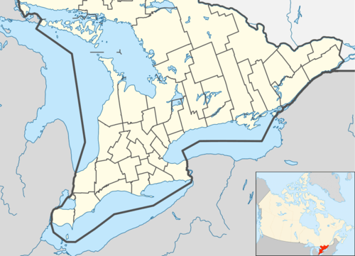
Madawaska Valley, Ontario
| Madawaska Valley | |
|---|---|
| Township (lower-tier) | |
| Township of Madawaska Valley | |
|
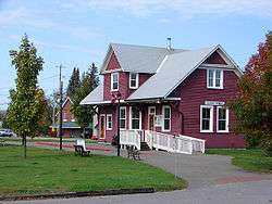
Tourist office in Barry's Bay | |
 Madawaska Valley | |
| Coordinates: 45°30′N 77°40′W / 45.500°N 77.667°WCoordinates: 45°30′N 77°40′W / 45.500°N 77.667°W | |
| Country |
|
| Province |
|
| County | Renfrew |
| Formed | January 1, 2001 |
| Government | |
| • Reeve | Kim Love |
| • Federal riding | Renfrew—Nipissing—Pembroke |
| • Prov. riding | Renfrew—Nipissing—Pembroke |
| Area[1] | |
| • Land | 671.85 km2 (259.40 sq mi) |
| Population (2011)[1] | |
| • Total | 4,282 |
| • Density | 6.4/km2 (17/sq mi) |
| Time zone | EST (UTC-5) |
| • Summer (DST) | EDT (UTC-4) |
| Postal Code | K0J |
| Area code(s) | 613 |
| Website | www.madawaskavalley.on.ca |
Madawaska Valley is a township in Renfrew County, Ontario, Canada. It was formed on January 1, 2001, through the amalgamation of the village of Barry's Bay and the townships of Radcliffe and Sherwood Jones & Burns.
Communities
The municipality comprises the communities of Barry's Bay, Combermere, Halfway, Hopefield, Kaszuby, Mayhew's Landing, Paugh Lake, Siberia and Wilno.
Demographics
| Canada census – Madawaska Valley, Ontario community profile | |||
|---|---|---|---|
| 2011 | 2006 | 2001 | |
| Population: | 4282 (-2.3% from 2006) | 4381 (-0.6% from 2001) | 4406 (1.5% from 1996) |
| Land area: | 671.85 km2 (259.40 sq mi) | 670.11 km2 (258.73 sq mi) | 670.14 km2 (258.74 sq mi) |
| Population density: | 6.4/km2 (17/sq mi) | 6.5/km2 (17/sq mi) | 6.6/km2 (17/sq mi) |
| Median age: | 47.8 (M: 46.7, F: 49.0) | 44.0 (M: 42.7, F: 44.9) | |
| Total private dwellings: | 2748 | 2974 | 2724 |
| Median household income: | $39,211 | $35,921 | |
| References: 2011[2] 2006[3] 2001[4] | |||
Population trend:[5]
- Population in 2011: 4282
- Population in 2006: 4381
- Population in 2001: 4406
- Population total in 1996: 4342
- Barry's Bay: 1086
- Radcliffe township: 1116
- Sherwood, Jones and Burns township: 2140
- Population in 1991:
- Barry's Bay: 1088
- Radcliffe township: 1077
- Sherwood, Jones and Burns township: 2101
- Population in 2010: 4,056
Mother tongue:[6]
- English as first language: 82.1%
- French as first language: 1.1%
- English and French as first language: 0%
- Other as first language: 16.8%
See also
References
- 1 2 "Madawaska Valley census profile". 2011 Census of Population. Statistics Canada. Retrieved 2012-02-13.
- ↑ "2011 Community Profiles". Canada 2011 Census. Statistics Canada. July 5, 2013. Retrieved 2012-02-13.
- ↑ "2006 Community Profiles". Canada 2006 Census. Statistics Canada. March 30, 2011. Retrieved 2012-02-13.
- ↑ "2001 Community Profiles". Canada 2001 Census. Statistics Canada. February 17, 2012. Retrieved 2012-02-13.
- ↑ Statistics Canada: 1996, 2001, 2006 census
- ↑ Statistics Canada 2006 Census - Madawaska Valley community profile
External links
 |
Unorganized South Nipissing (Algonquin Provincial Park) |
| ||
| South Algonquin | |
Killaloe, Hagarty and Richards | ||
| ||||
| | ||||
| Hastings Highlands | Brudenell, Lyndoch and Raglan |
| Cities | 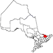 | |
|---|---|---|
| Towns | ||
| Townships | ||
| First Nations | ||
| Indian reserves | ||
| ||
This article is issued from Wikipedia - version of the 6/3/2015. The text is available under the Creative Commons Attribution/Share Alike but additional terms may apply for the media files.