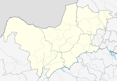
Mathibestad
| Mathibestad | |
|---|---|
 Mathibestad 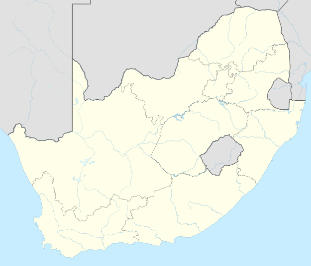 Mathibestad  Mathibestad
| |
| Coordinates: 25°16′34″S 28°10′41″E / 25.276°S 28.178°ECoordinates: 25°16′34″S 28°10′41″E / 25.276°S 28.178°E | |
| Country | South Africa |
| Province | North West |
| District | Bojanala Platinum |
| Municipality | Moretele |
| Area[1] | |
| • Total | 24.02 km2 (9.27 sq mi) |
| Population (2011)[1] | |
| • Total | 25,945 |
| • Density | 1,100/km2 (2,800/sq mi) |
| Racial makeup (2011)[1] | |
| • Black African | 99.7% |
| • Indian/Asian | 0.1% |
| • Other | 0.1% |
| First languages (2011)[1] | |
| • Tswana | 51.7% |
| • Tsonga | 18.8% |
| • Northern Sotho | 14.7% |
| • Sotho | 3.3% |
| • Other | 11.4% |
| PO box | 0418 |
Mathibestad is a town in Bojanala District Municipality in the North West province of South Africa.
References
- 1 2 3 4 "Main Place Mathibestad". Census 2011.
Municipalities and communities of Bojanala Platinum District Municipality, North West | ||
|---|---|---|
District seat: Rustenburg | ||
| Moretele | .svg.png) | |
| Madibeng | ||
| Rustenburg | ||
| Kgetlengrivier | ||
| Moses Kotane | ||
This article is issued from Wikipedia - version of the 12/30/2013. The text is available under the Creative Commons Attribution/Share Alike but additional terms may apply for the media files.