Manuel Tames
| Manuel Tames | |
|---|---|
| Municipality | |
.png) Manuel Tames municipality (red) within Guantánamo Province (yellow) and Cuba | |
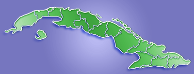 Location of Manuel Tames in Cuba | |
| Coordinates: 20°10′49″N 75°03′5″W / 20.18028°N 75.05139°WCoordinates: 20°10′49″N 75°03′5″W / 20.18028°N 75.05139°W | |
| Country |
|
| Province | Guantánamo |
| Seat | Jamaica |
| Area[1] | |
| • Total | 526 km2 (203 sq mi) |
| Elevation | 175 m (574 ft) |
| Population (2004)[2] | |
| • Total | 14,200 |
| • Density | 27.0/km2 (70/sq mi) |
| Time zone | EST (UTC-5) |
| Area code(s) | +53-21 |
Manuel Tames is a municipality and town in the Guantánamo Province of Cuba. Its administrative seat is located in the town of Jamaica.[1]
Geography
The town is locatedzlzl 15 kilometres (9.3 mi) east of the provincial capital, Guantánamo.
Demographics
In 2004, the municipality of Manuel Tames had a population of 14,200.[2] With a total area of 526 km2 (203 sq mi),[1] it has a population density of 27.0/km2 (70/sq mi).
See also
References
- 1 2 3 Statoids. "Municipios of Cuba". Retrieved 2007-10-05.
- 1 2 Atenas.cu (2004). "2004 Population trends, by Province and Municipality" (in Spanish). Retrieved 2007-10-05.
External links
![]() Media related to Manuel Tames at Wikimedia Commons
Media related to Manuel Tames at Wikimedia Commons
This article is issued from Wikipedia - version of the 1/30/2016. The text is available under the Creative Commons Attribution/Share Alike but additional terms may apply for the media files.